Topographic Maps
Precision mapping for smarter decisions.
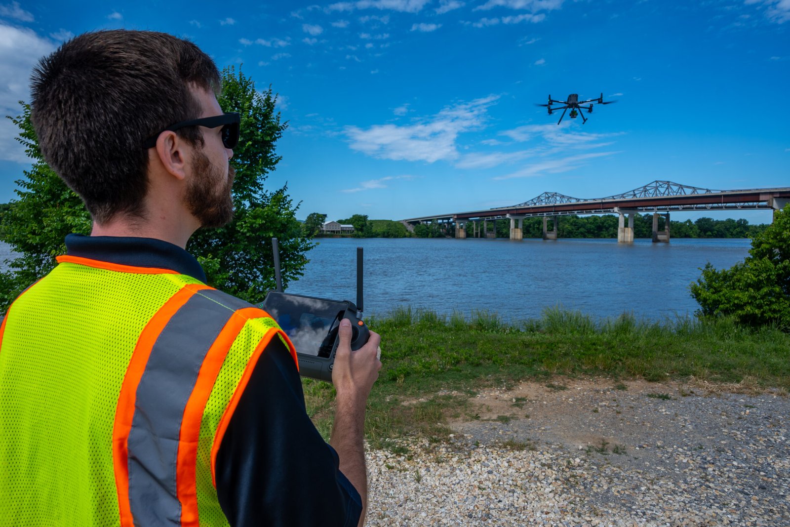
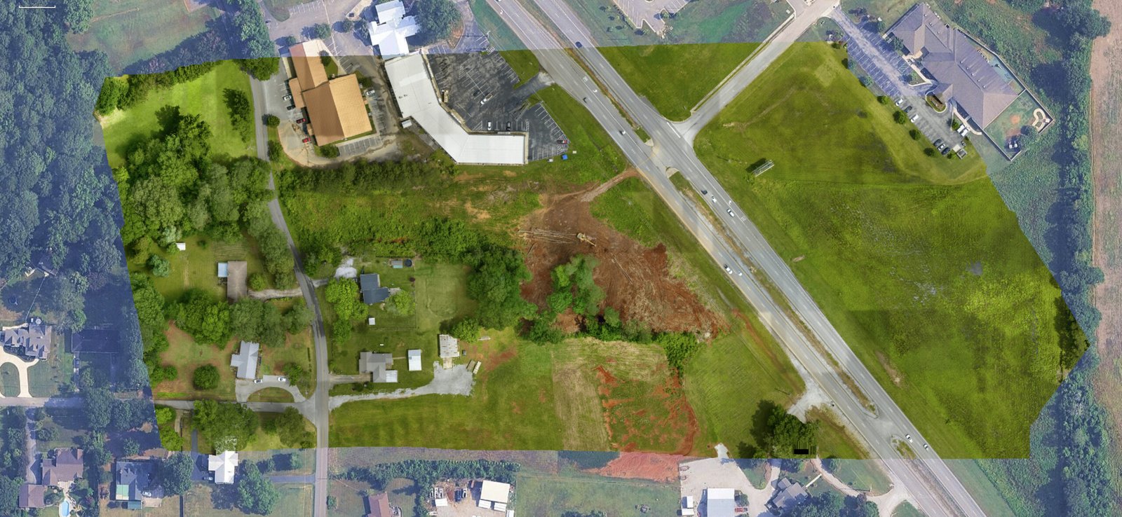
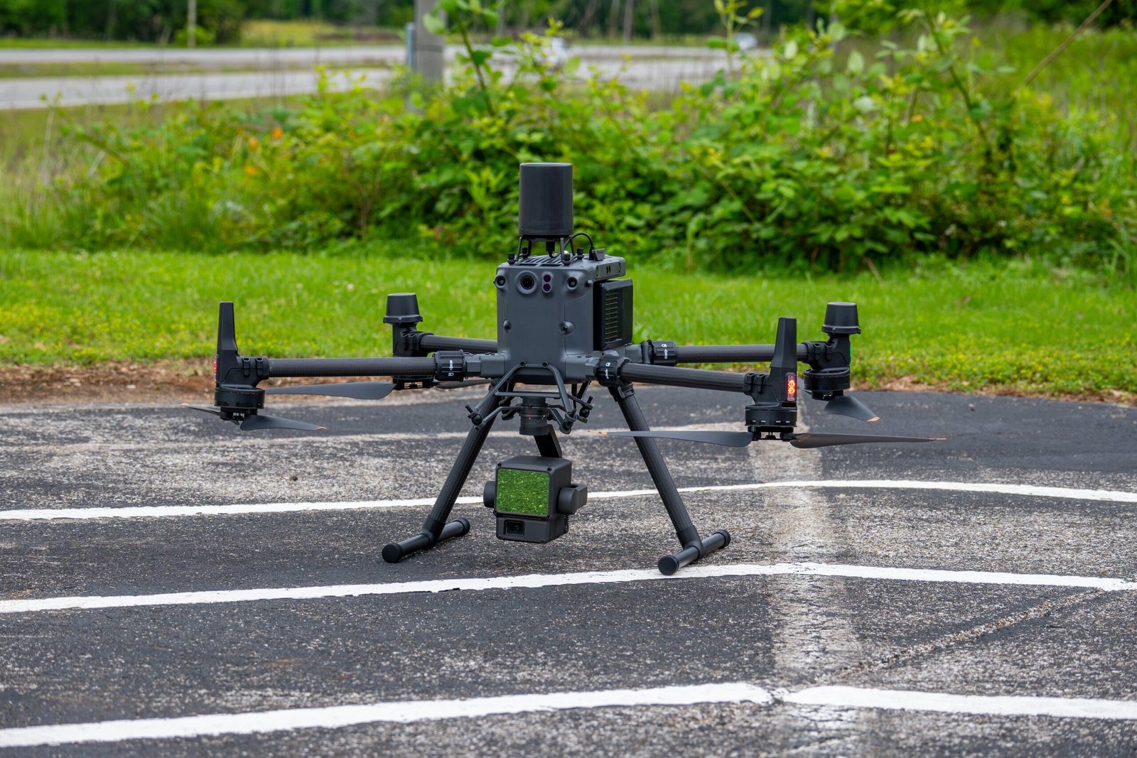
Bush Drone Data delivers high-resolution topographic datasets to support surveyors, land developers, construction, engineering, design, architecture, infrastructure, and environmental teams. Using drone-mounted LiDAR and photogrammetry, we capture decision-ready surfaces in days—not weeks.
Why Choose Bush Drone Data
Faster turnarounds
Large or complex sites completed in days, speeding approvals and project starts.
Engineering-grade accuracy
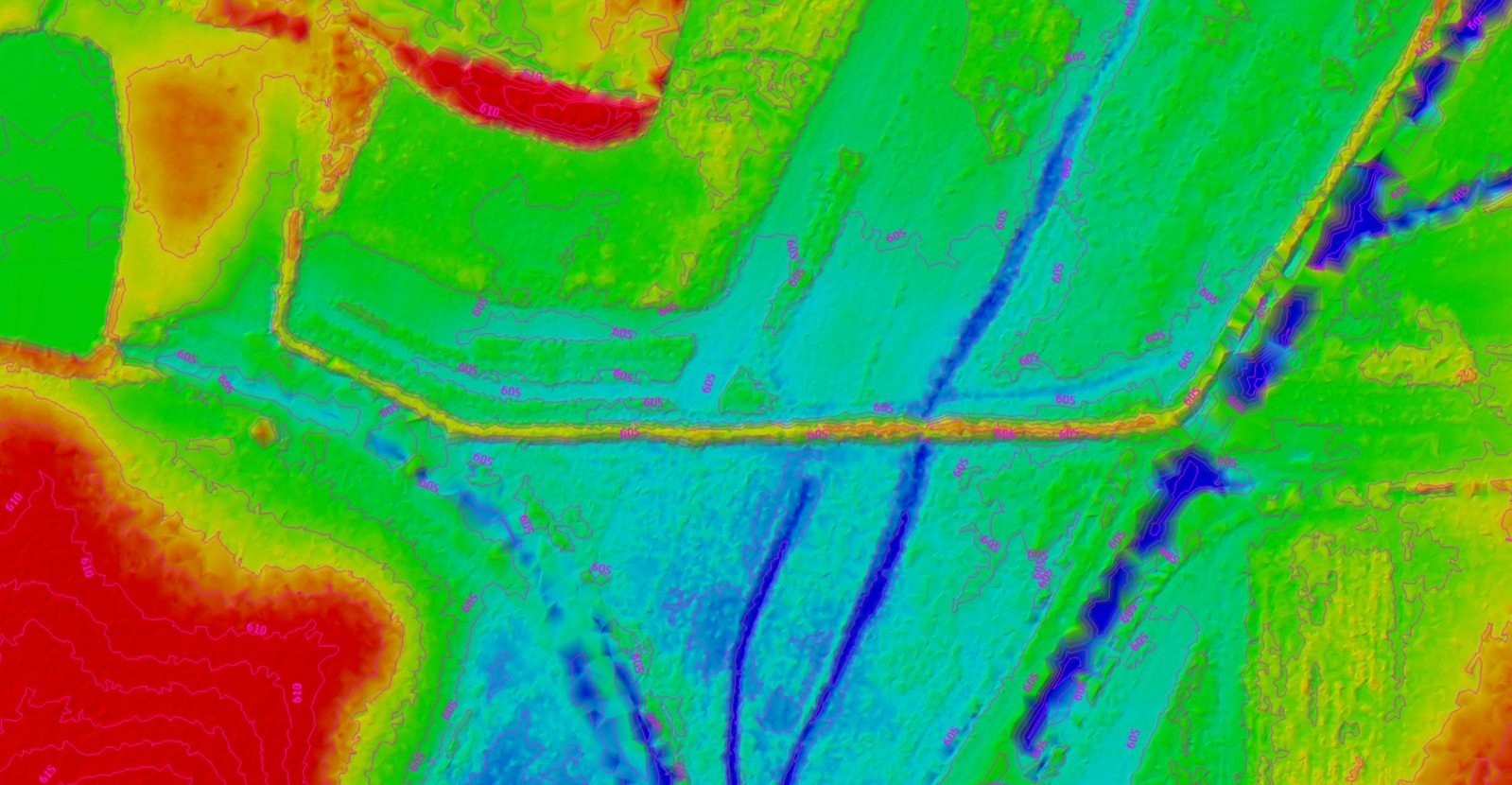
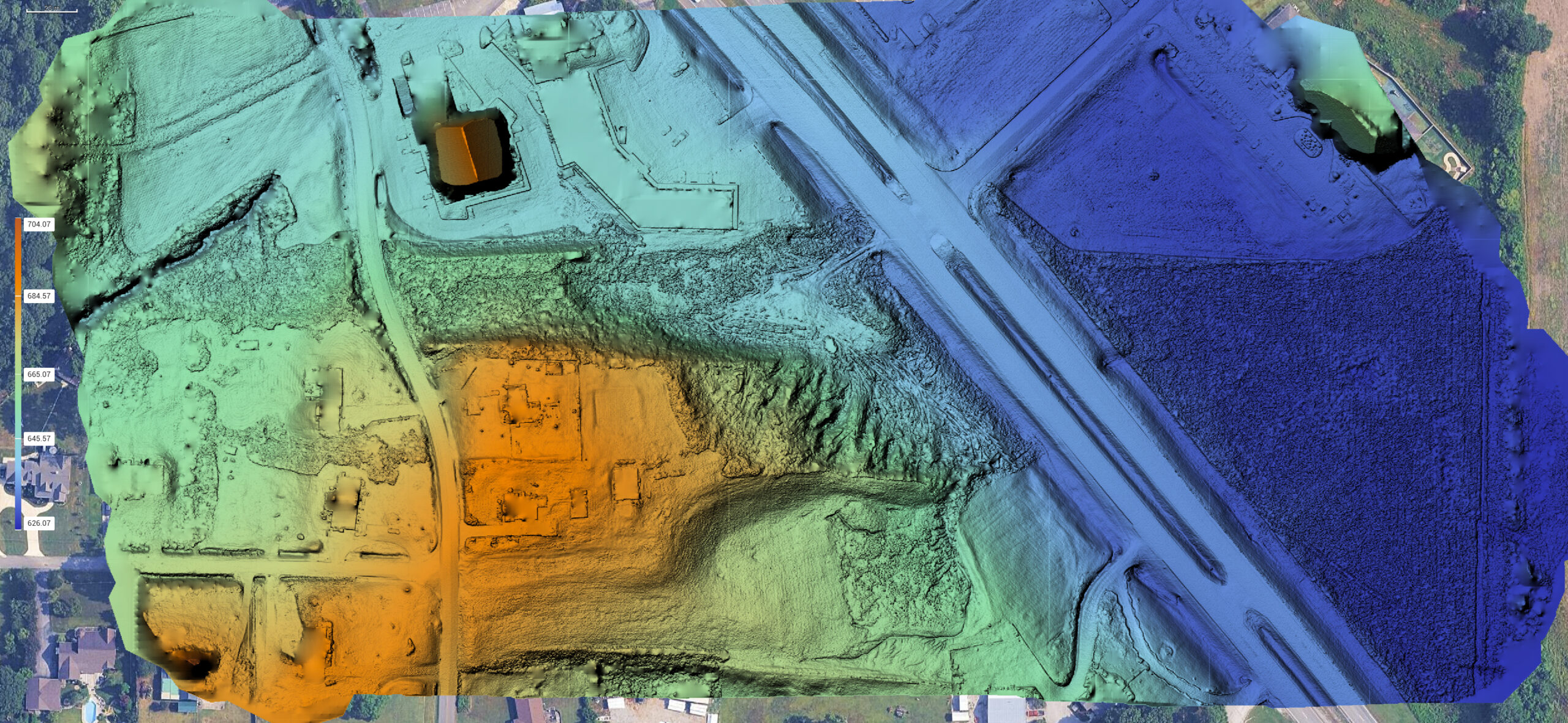
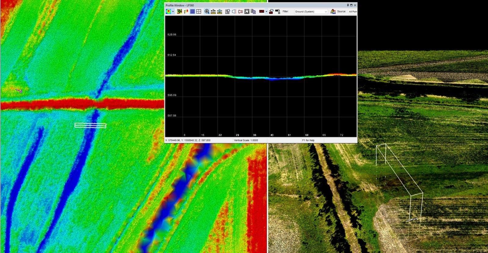
Utilizing the latest drone technology and calibrated optics for centimeter-level DTMs/DSMs and contours.
Cost-efficient execution
Lean field ops and minimal mobilization reduce overall project costs without compromising quality.
Safer data collection
We map steep slopes, active sites, and sensitive areas without exposing crews to risk.
Who We Support
Surveying & Land Development
Construction & Civil Engineering
Architecture & Site Design
Transportation & Utilities
Environmental & Watershed Studies
Mining & Earthworks
- And more…
What We Deliver
Surface models
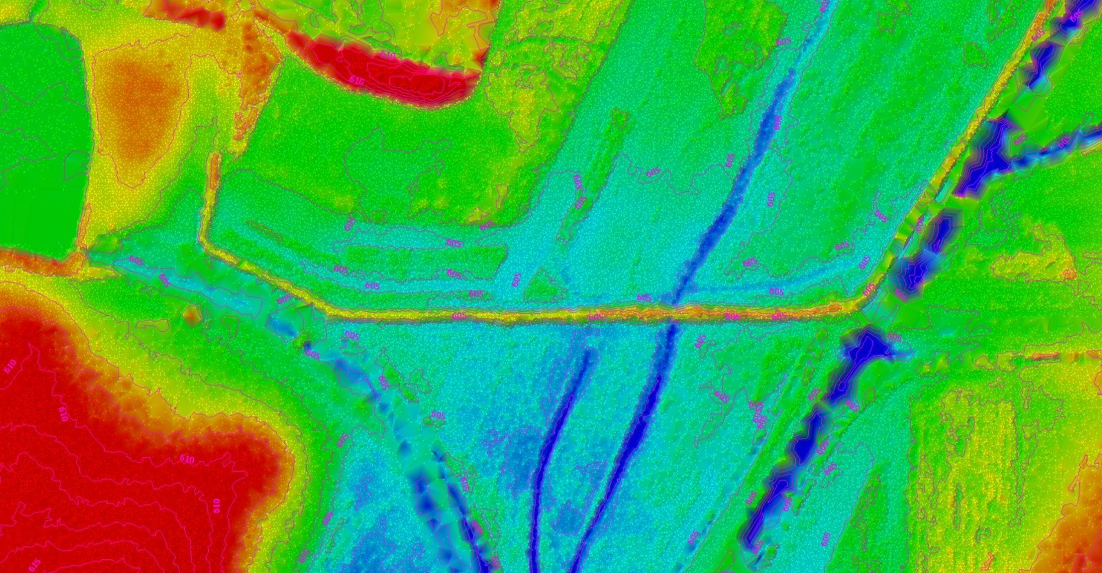
DTM / DSM
Contours (typ. 0.5–2 ft)
Hillshade, slope, aspect
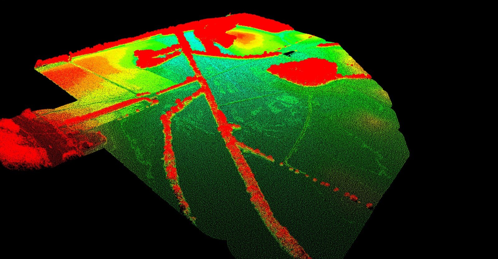
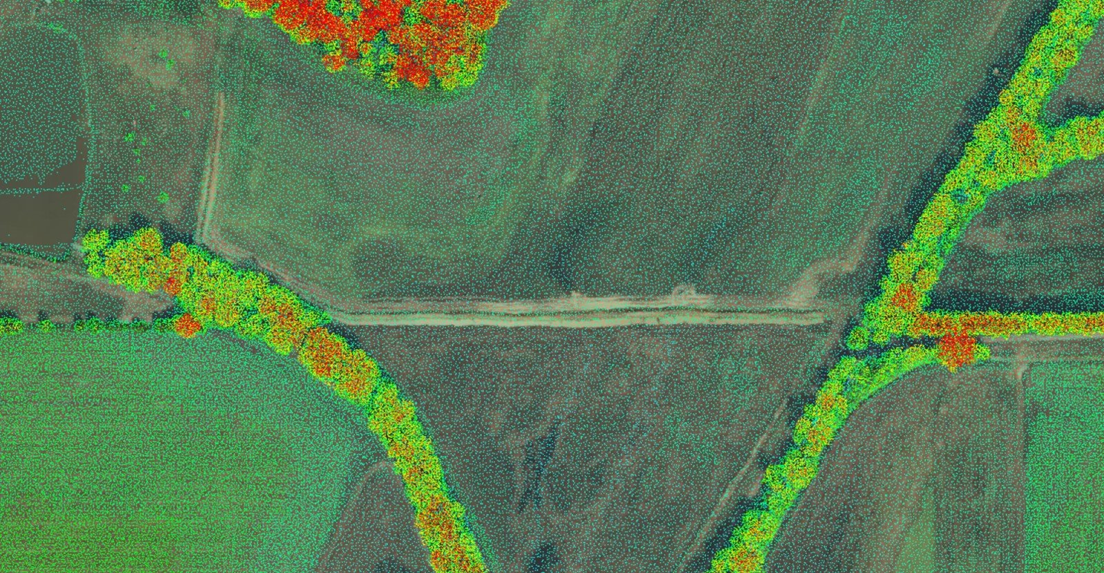
Point clouds
Classified LAS/LAZ
Ground / non-ground / vegetation / structures
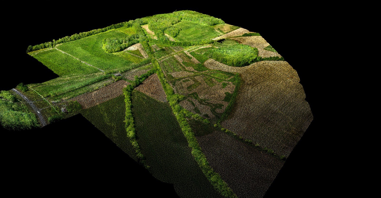
Orthomosaics
Georeferenced imagery (GeoTIFF)
High ground sampling distance (GSD)
CAD/GIS packages
DWG / DXF, LandXML
SHP / GeoPackage
Tiled web layers
Project documentation
Accuracy statement with RMSE
Control layout and metadata
Acquisition & processing notes
Integration & Hand-Off
Native compatibility with AutoCAD, Civil 3D, ArcGIS
Delivery in client-specified EPSG / State Plane / UTM / local site coordinates
Secure file transfer options and versioned deliverables
Safety, Compliance & Coverage
FAA-certified pilots and fully insured operations
Airspace and local compliance handled end-to-end
Minimal site disruption and reduced personnel exposure
FAQs
What accuracy can I expect?
Engineering-grade results are typical with RTK/PPK and appropriate control. We include RMSE summaries and check shots.
How do you handle vegetation?
Multi-return LiDAR with ground classification penetrates canopy where feasible, supplemented by targeted control/check shots.
Which coordinate systems do you support?
State Plane, UTM, local site coordinates, and custom transformations per project specs.
Can you work with our CAD/GIS stack?
Yes. We deliver DWG/DXF, LandXML, SHP/GeoPackage, and web tiles for seamless import.
Put Us to the Test
Have a previous quote? Share it with us. We’ll present a plan to deliver faster timelines, higher-fidelity data, and reduced total project cost compared to traditional multi-week ground efforts.
[Request a Quote]
Topographic Maps
Precision Mapping for Smarter Decisions
At Bush Drone Data, we specialize in providing advanced aerial mapping and data solutions that empower professionals in surveying, land development, construction, engineering, design, architecture, infrastructure, environmental monitoring, and more. By leveraging drone-mounted LiDAR sensors, photogrammetry, and GIS workflows, we capture and process highly detailed elevation data to support confident decision-making at every stage of a project.
Our approach replaces weeks of traditional ground-based data collection with efficient aerial workflows completed in a fraction of the time. The result: precise, reliable datasets that integrate seamlessly into CAD and GIS systems—delivered faster, with exceptional accuracy, and at reduced logistical cost.
Why Choose Drone-Based Topographic Maps?
Accelerated Project Timelines
Traditional crews may take weeks or even months to capture and process data for large or complex sites. With our drone-based solutions, we can complete the same level of detail in just days, enabling faster project starts, quicker approvals, and reduced downtime for clients.
Unmatched Accuracy & Resolution
Our fleet includes state-of-the-art drones equipped with the latest technology and high-resolution imaging sensors, capturing millions of data points per second. This allows us to create detailed Digital Terrain Models (DTMs), Digital Surface Models (DSMs), and contour maps with centimeter-level precision, ensuring clients can trust the data for critical applications.
Reduced Field Costs
By minimizing the need for large crews, extensive equipment mobilization, and prolonged field time, we streamline the data acquisition process. This results in lower overall project costs, freeing resources for other priorities—without compromising on quality or safety.
Safety & Accessibility
Drone maps eliminate the need for crews to access hazardous or inaccessible terrain. From steep slopes and active construction zones to environmentally sensitive areas, drones allow us to capture comprehensive data without risk to personnel or disruption to the environment.
Applications Across Industries
Our topographic maps deliver essential insights to support professionals across a wide range of industries:
Surveying & Land Development – Contour mapping, grading plans, and subdivision layouts.
Construction & Engineering – Cut-and-fill calculations, site progress monitoring, and pre/post-construction verification.
Architecture & Design – Foundational planning supported by detailed elevation models and slope analysis.
Infrastructure Development – Roadways, bridges, pipelines, and utility corridors mapped efficiently and accurately.
Environmental Monitoring – Erosion control, watershed mapping, floodplain analysis, and ecological assessments.
Mining & Earthworks – Stockpile volumetrics, excavation tracking, and terrain stability monitoring.
The Bush Drone Data Advantage
When you choose Bush Drone Data, you gain a partner that brings:
Cutting-Edge Equipment – The latest drones paired with advanced LiDAR and photogrammetry technology.
GIS Integration – Deliverables tailored for AutoCAD, Civil 3D, ArcGIS, and other industry-standard platforms.
Rapid Turnaround – Aerial data acquisition and processing workflows designed for efficiency.
Proven Expertise – FAA-certified pilots with geospatial and cartographic backgrounds.
Regulatory Compliance – Full adherence to federal, state, and local regulations, backed by comprehensive insurance.
Local Knowledge – Operating across North Alabama, with an understanding of regional terrain and development needs.
See the Difference for Yourself
Already have a quote? Share it with us. Bush Drone Data will demonstrate how we can deliver faster, more accurate, and more cost-effective solutions—while upholding the highest standards of quality and professionalism.
[Request a Quote Today]