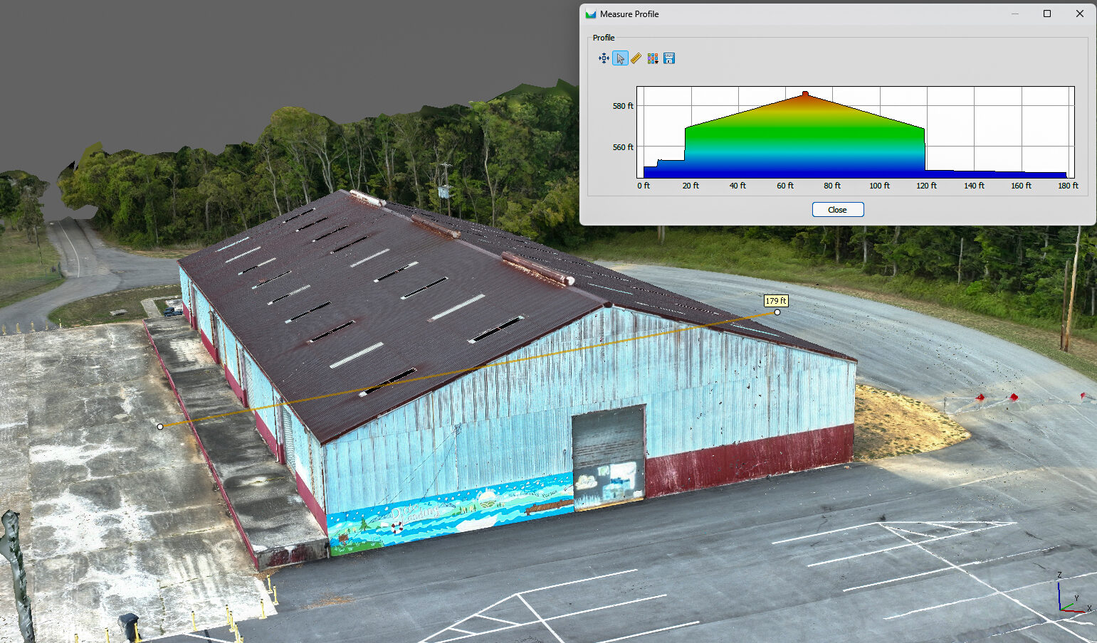
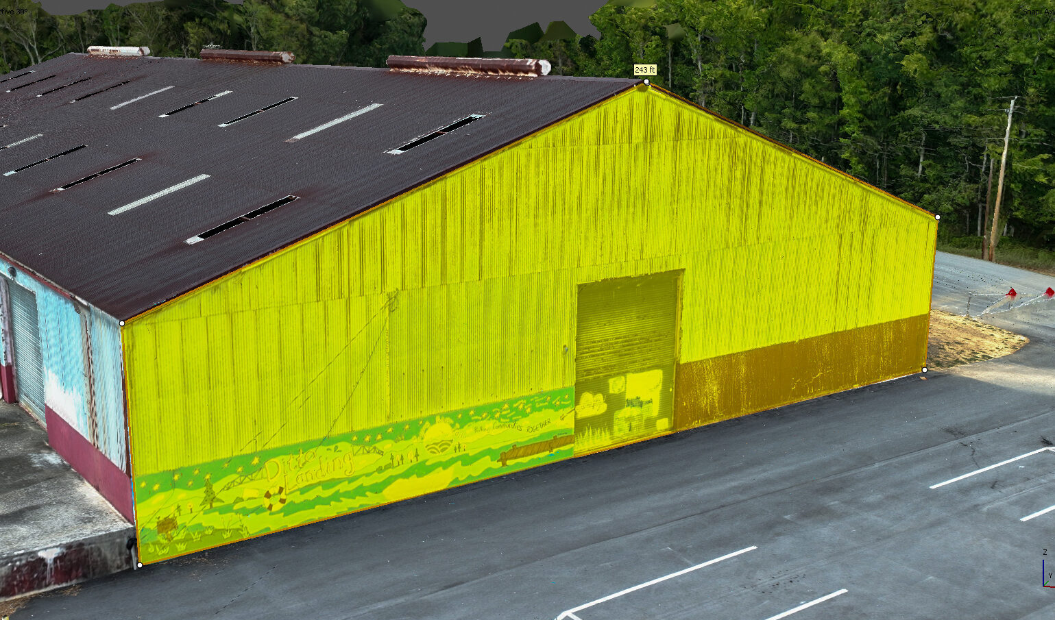
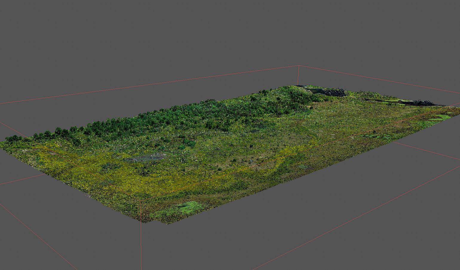
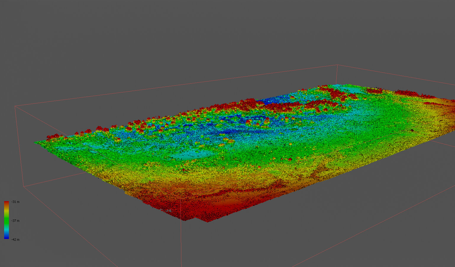
Get precise volume measurements with Bush Drone Data’s aerial volumetrics services.
We provide:
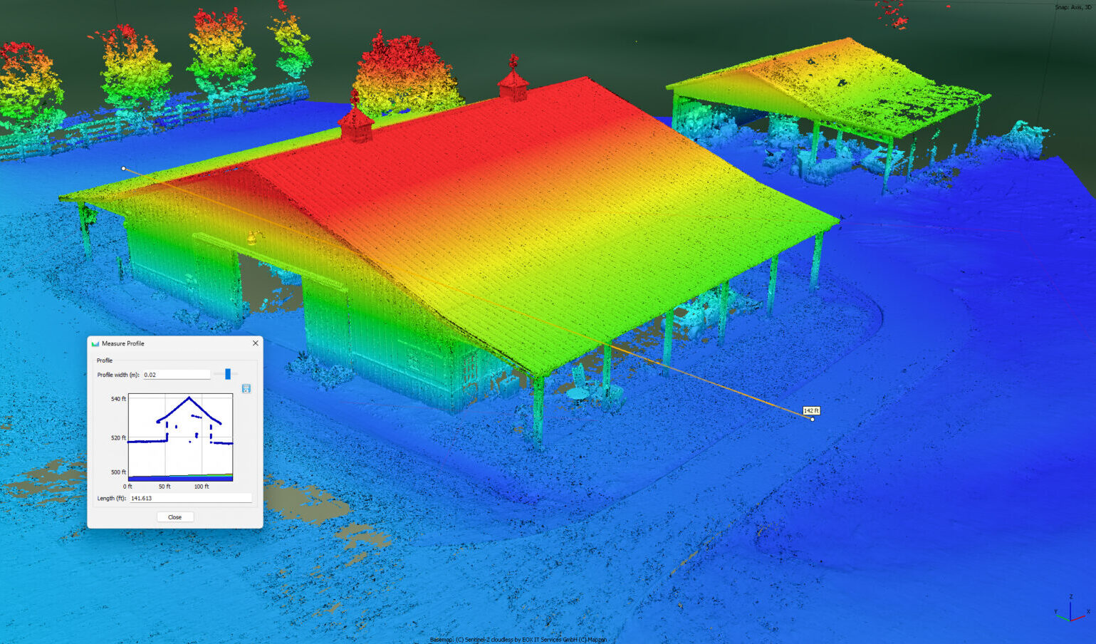
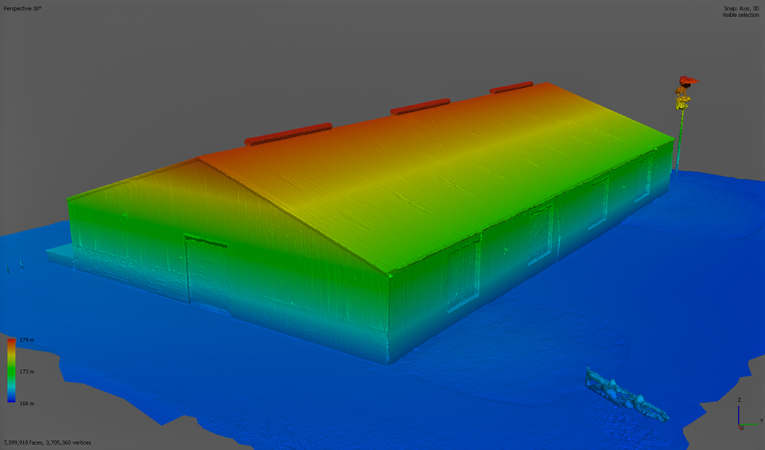
Accurate calculations of earthworks, stockpiles & structures
High-resolution drone imagery
Actionable insights for planning & evaluation
From construction to land management, our volumetric data supports smart, informed decision-making.
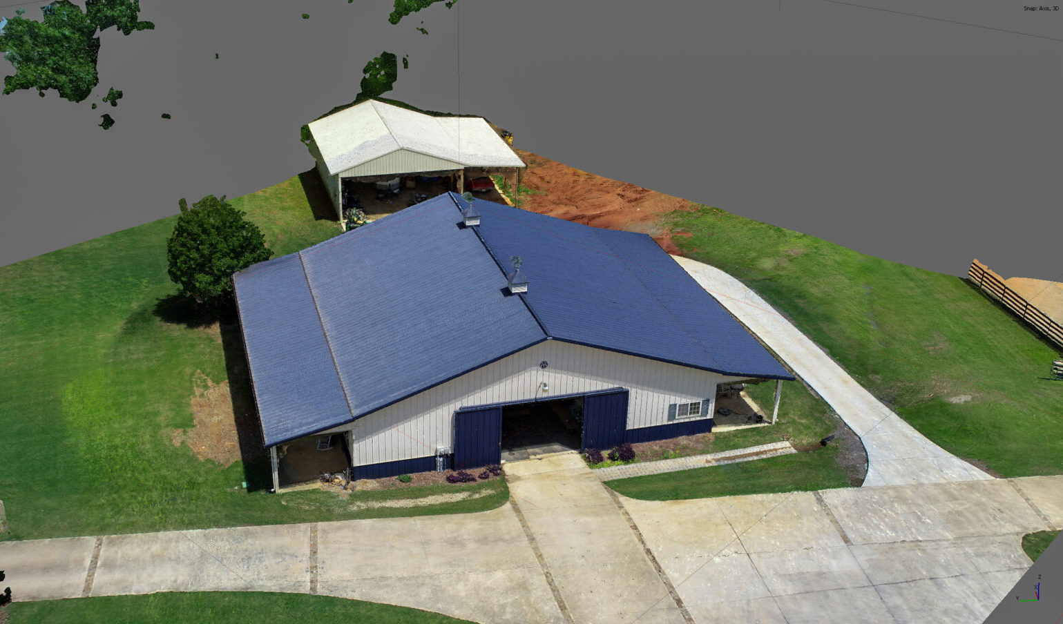
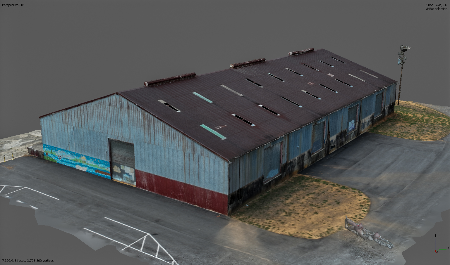
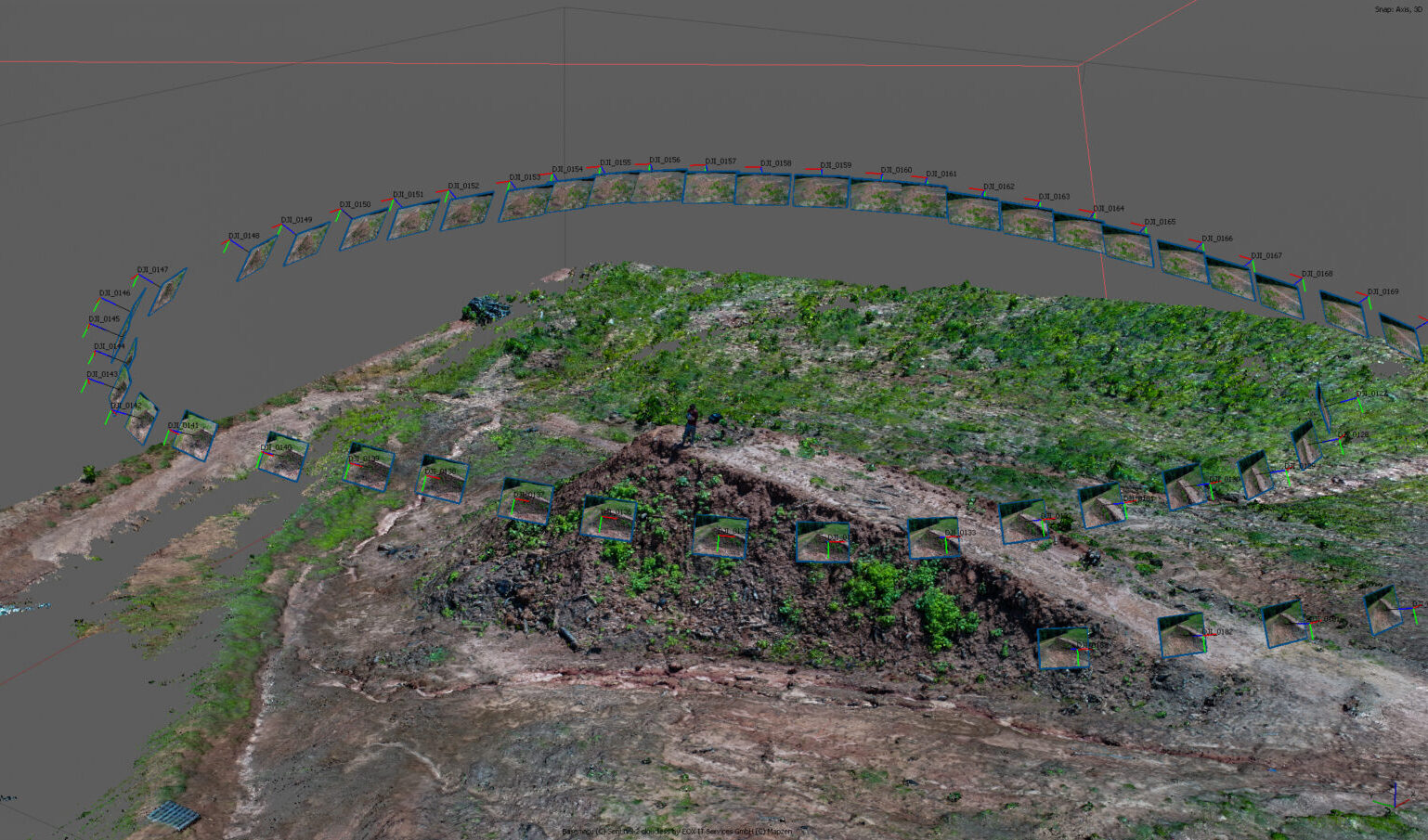
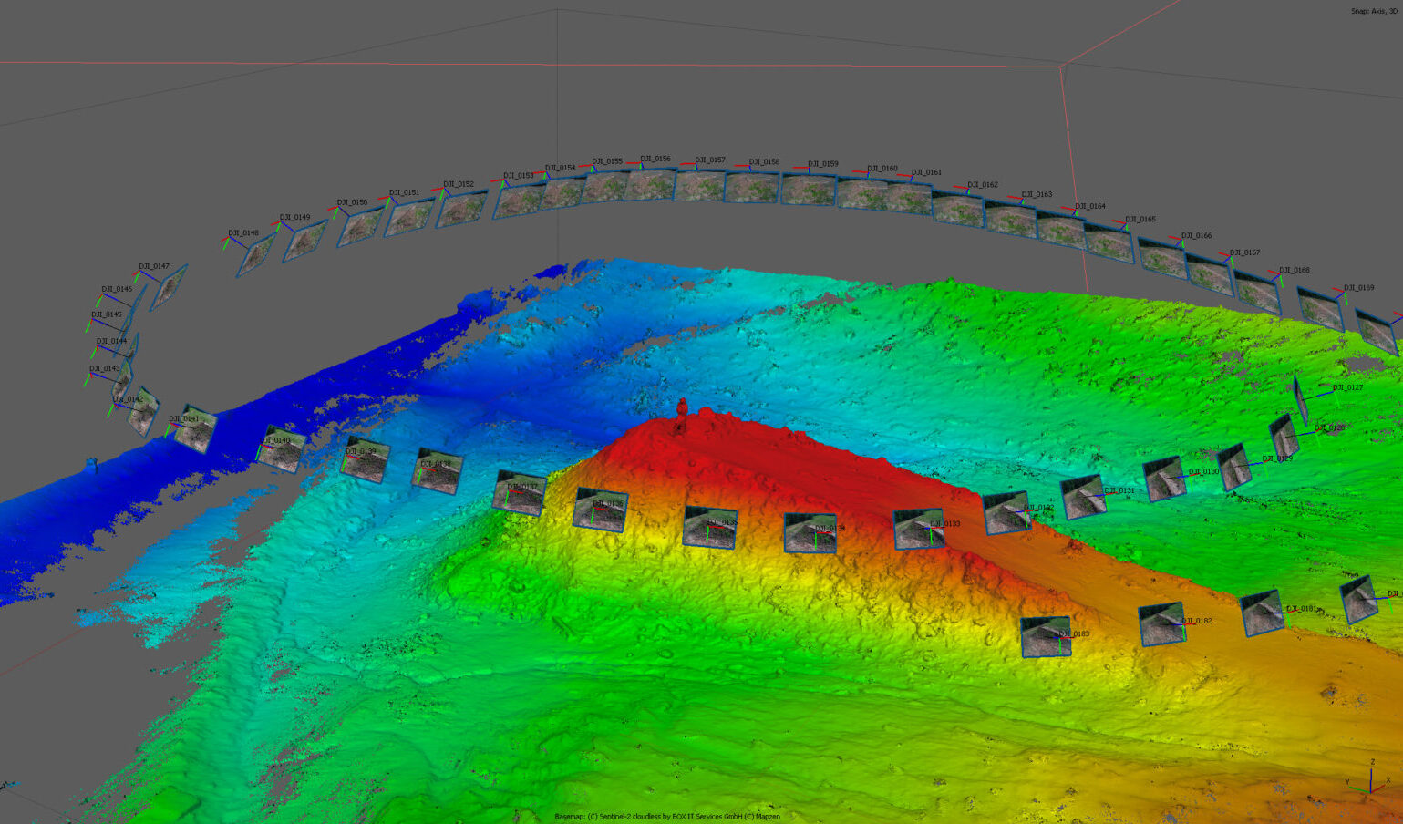
Elevate your spatial analysis with Bush Drone Data’s drone-based spatial volumetrics services. We deliver precise and detailed volumetric measurements of landscapes, structures, and objects through advanced aerial data collection.
Utilizing high-resolution drone imagery, we provide accurate volumetric calculations and in-depth spatial insights, enhancing project planning and evaluation. Our spatial volumetrics services offer essential data for diverse applications, ensuring a thorough understanding and informed decision-making.
Office Hours
Contact Us
Have a question or a project in mind? We’re here to help. Call today or send an email to info@bushdronedata.com to discuss your surveying needs and learn how our drone-based solutions can support your project with precise, reliable geospatial data.