Photogrammetry: High-Precision Aerial Mapping & Modeling
At Bush Drone Data, we elevate photogrammetry by using RTK GNSS-equipped drones to deliver highly accurate and efficient geospatial data. With Real-Time Kinematic (RTK) satellite positioning, we produce maps, models, and measurements that meet professional-grade standards for accuracy and precision.
Why it matters:
Traditional data collection methods can be slow, expensive, and prone to human error. Our drone-based photogrammetry solutions are fast, cost-effective, and deliver high-resolution data—empowering smarter decisions in construction, infrastructure, agriculture, environmental management, and beyond.
Scalable. Reliable. Precise.
What is Photogrammetry?
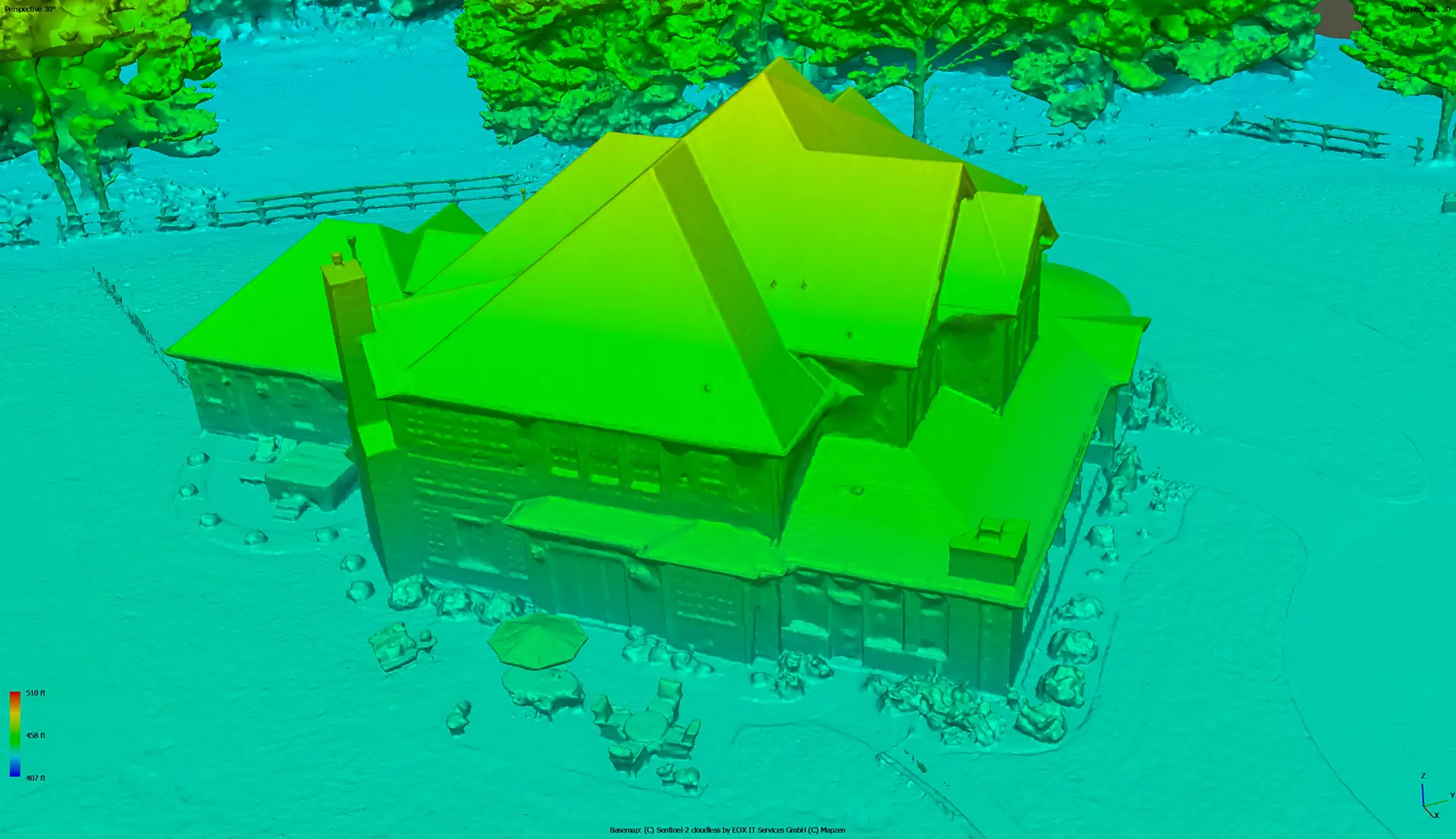
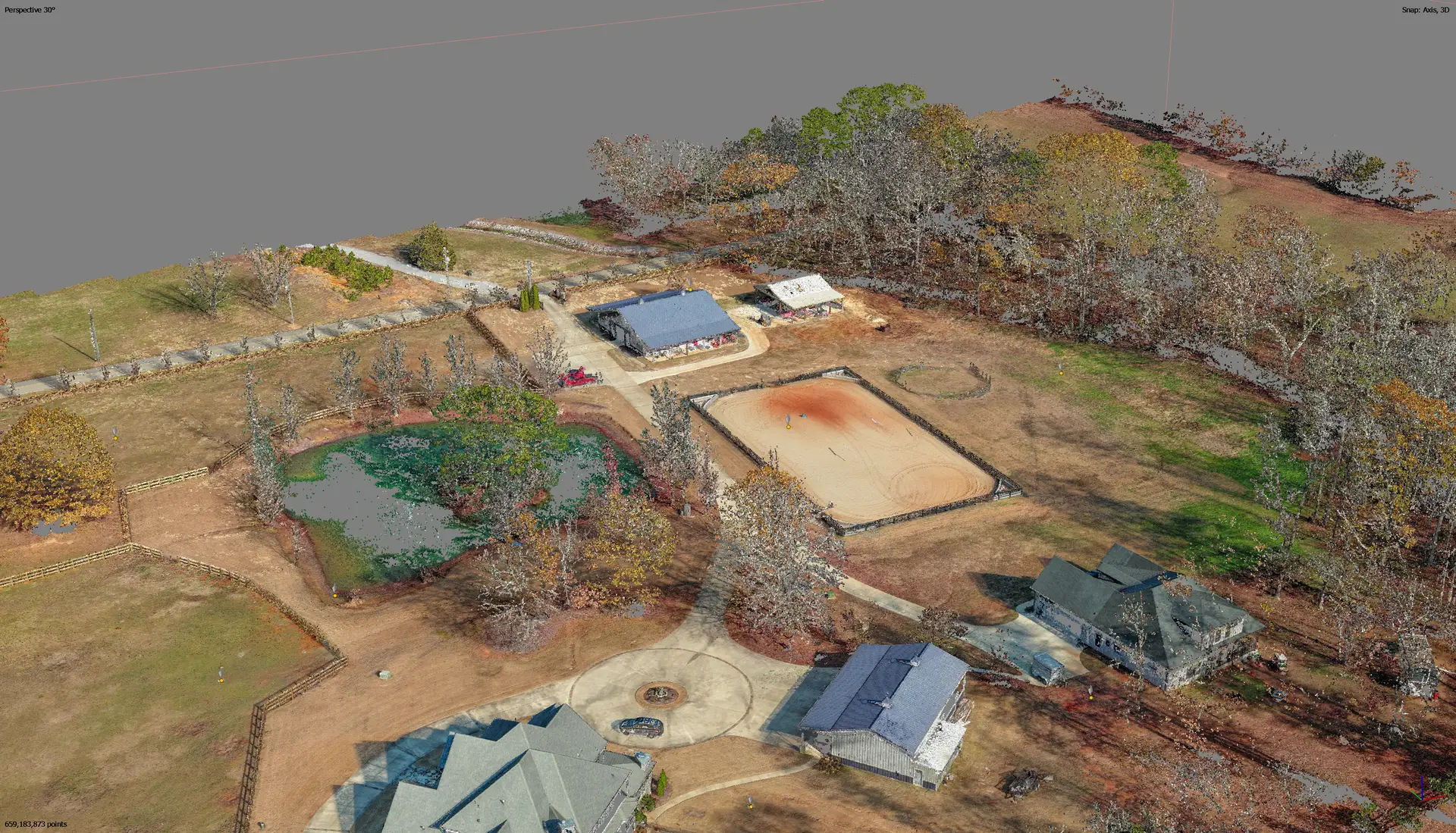
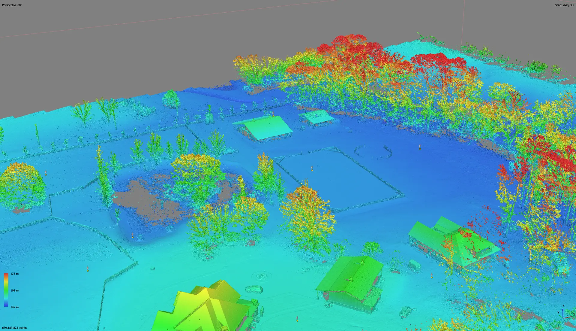
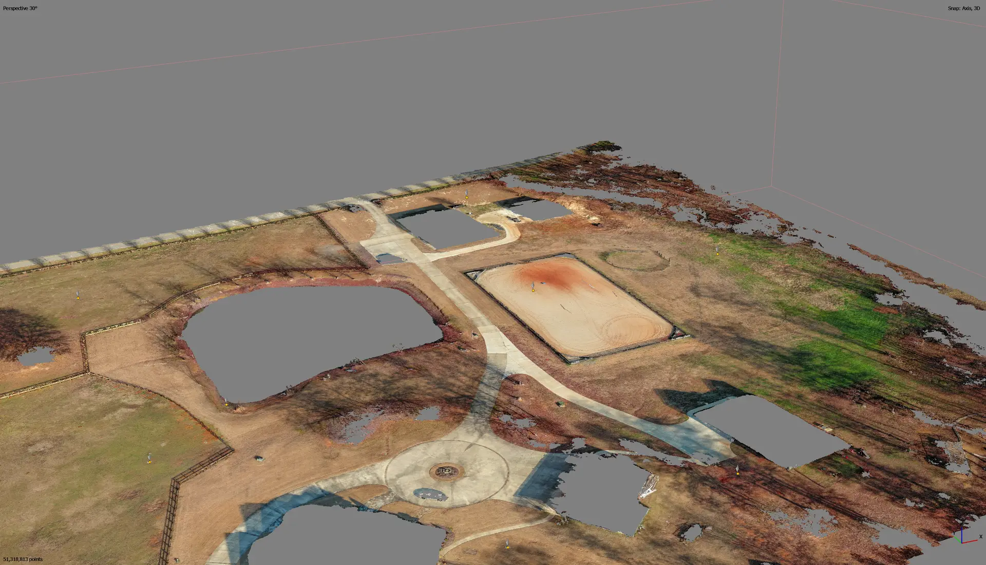
Photogrammetry is the science of turning photographs into precise spatial data—used to create accurate 2D maps and 3D models of the earth’s surface.
At Bush Drone Data, we use high-resolution drone cameras paired with RTK GNSS technology to capture overlapping aerial images. These images are processed into georeferenced datasets with exceptional accuracy.
With RTK GNSS, we deliver:
Centimeter-level accuracy for every map and model
Georeferenced imagery aligned to real-world coordinates
Reliable data with minimal distortion and high precision
This makes our photogrammetry solutions ideal for industries where accuracy is critical—like construction, infrastructure, and land planning.
Why RTK GNSS Matters
RTK GNSS (Real-Time Kinematic Global Navigation Satellite System) revolutionizes photogrammetry by enabling real-time satellite correction—eliminating the need for extensive manual ground control point (GCP) setups.
What this means for you:
Faster Data Collection
Skip the time-consuming GCP placement in most projects.Improved Accuracy
Achieve centimeter-level precision for maps, models, and spatial analysis.Reduced Processing Time
Real-time corrections eliminate lengthy post-processing workflows.Seamless Integration
Easily align outputs with GIS, CAD, and construction tools.
Example:
A construction firm using RTK GNSS-equipped drone photogrammetry can generate accurate topographic models within hours—not days—dramatically reducing time and labor costs.
Key Benefits of Drone Photogrammetry
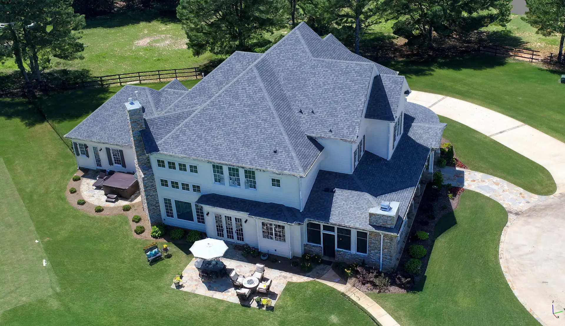
1. Unmatched Precision & Accuracy
By integrating photogrammetry with RTK GNSS, we deliver centimeter-level accuracy in every map, model, and measurement. This precision is essential for industries like construction, land surveying, and engineering, where data integrity is non-negotiable.
What You Get:
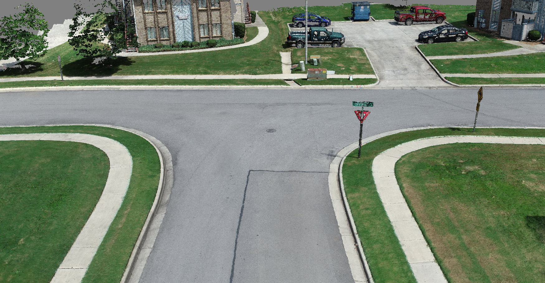
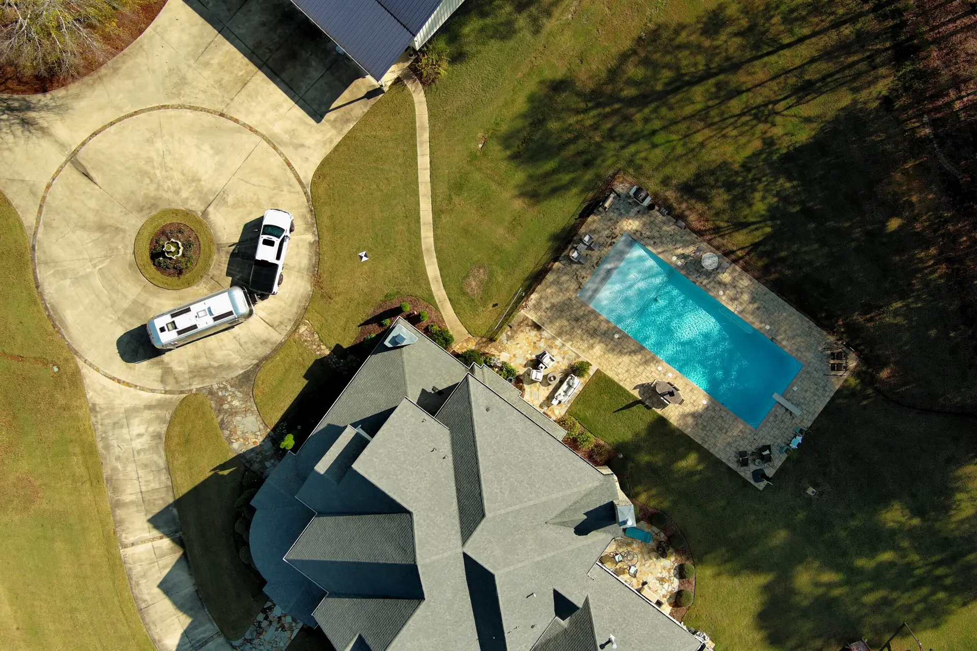
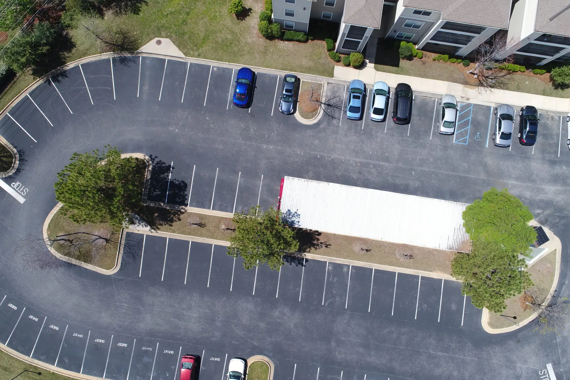
✔ High-resolution 2D orthomosaics for site planning
✔ Accurate 3D models for volumetric analysis and inspections
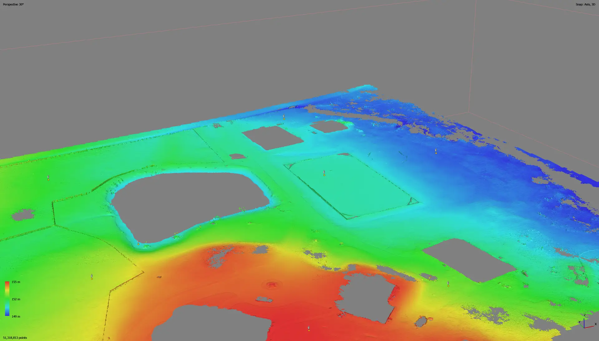
✔ Reliable elevation data for grading and terrain mapping
2. Time & Cost Efficiency
Traditional surveying is labor-intensive and time-consuming. Drone photogrammetry streamlines the process, delivering fast, cost-effective results without compromising accuracy.
Key Advantages:
✔ Map large areas in a fraction of the time
✔ Reduce labor costs by replacing manual ground surveys
✔ Get rapid deliverables—most flights take under two hours
Example:
A land development firm needs an elevation model for a new subdivision. Instead of deploying a survey crew for several days, our drone maps the site in a single flight—delivering accurate terrain data within hours.
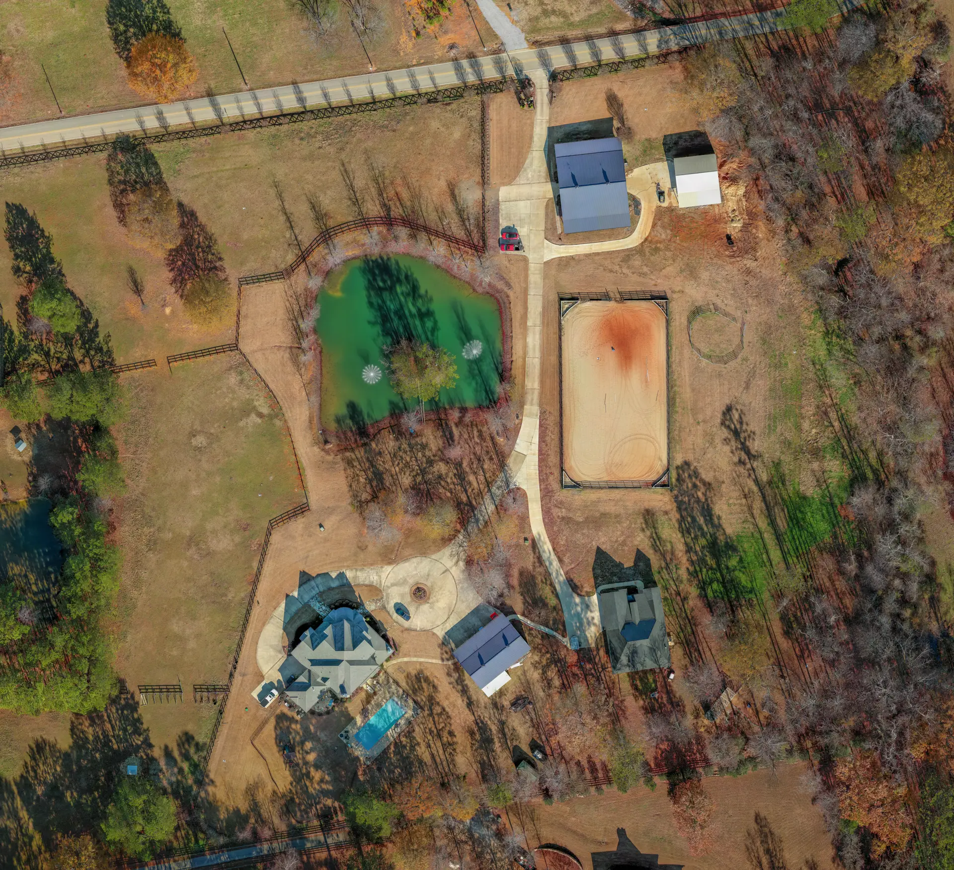
3. Versatile Applications Across Industries
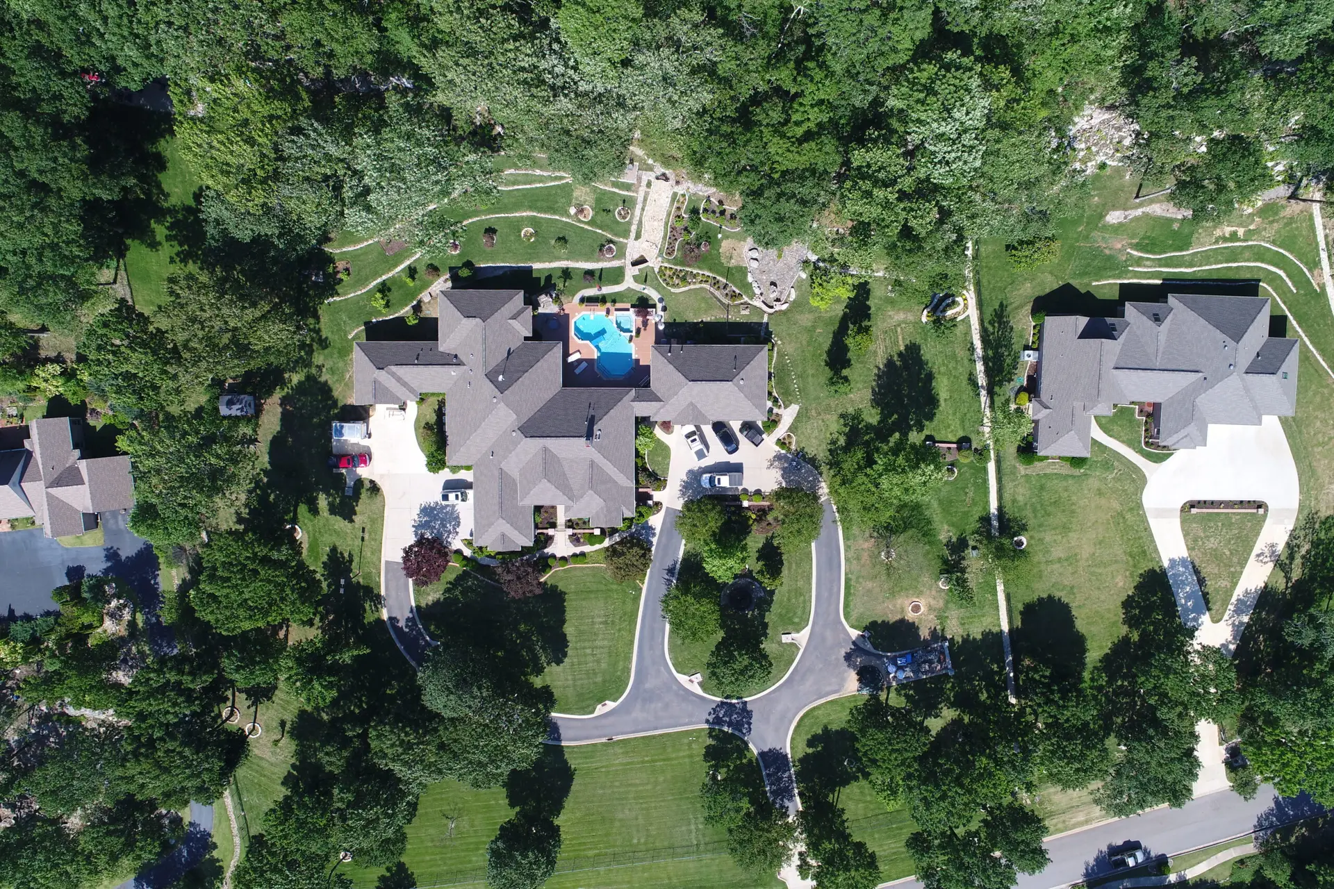
Our drone photogrammetry solutions scale to meet the needs of any project—from compact job sites to large infrastructure developments. Whether you’re mapping a single lot or building a digital twin, we deliver data tailored to your goals.
Industries That Benefit:
Construction & Development
Site planning, progress tracking, and volume measurementsAgriculture & Land Management
Crop health analysis, irrigation planning, and field mappingReal Estate & Property Management
High-resolution visuals and 3D models for marketing and evaluationInfrastructure & Utilities
Powerline inspections, asset monitoring, and urban developmentGIS & Surveying
Geospatial mapping, elevation models, and contour analysis
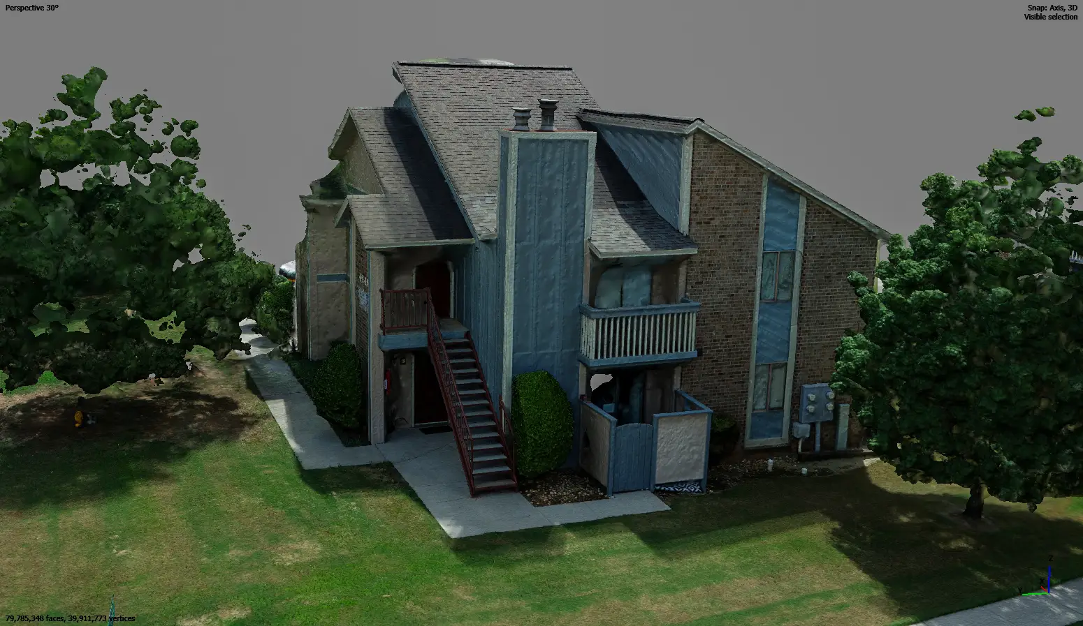
Our Photogrammetry Process
At Bush Drone Data, we use a structured, three-phase workflow to deliver precision, efficiency, and quality at every stage.
1. Data Capture
-
RTK-equipped drones capture high-resolution images with precise overlap
-
Centimeter-level georeferencing using RTK and optional ground control points
-
Configurable flight modes for 2D maps, 3D models, and elevation analysis
2. Data Processing & Georeferencing
-
Advanced photogrammetry software stitches images into orthomosaics, 3D models, and digital elevation models (DEMs)
-
RTK data ensures pinpoint-accurate spatial positioning
-
Output formats compatible with GIS, CAD, and BIM platforms
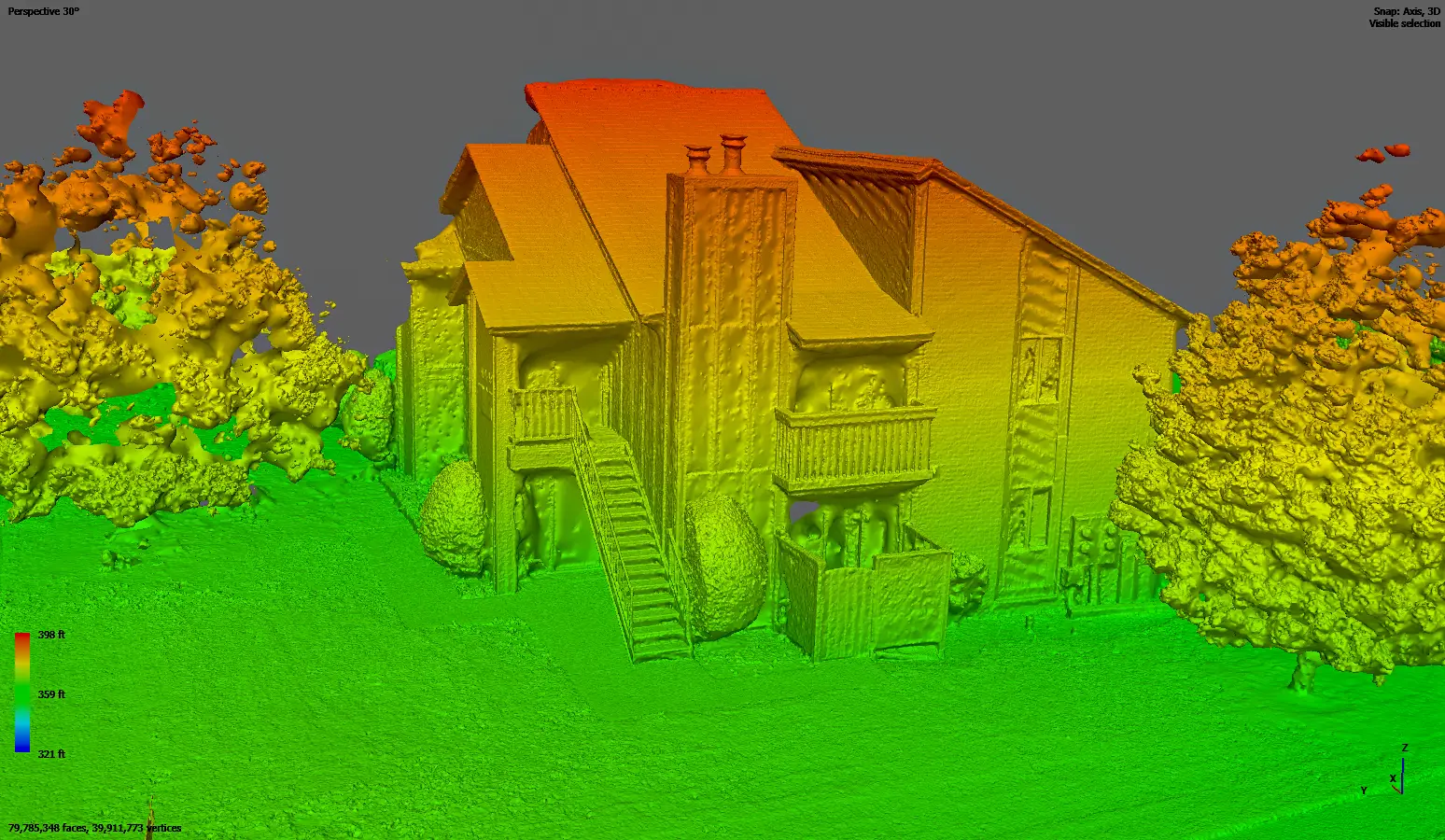
3. Quality Control & Validation
-
Accuracy confirmed through automated and manual QA checks
-
Ground-truth validation integrated with licensed surveyor datasets when needed
-
Final outputs tailored to your project’s technical and industry-specific requirements
Why Choose Bush Drone Data for Photogrammetry?
RTK GNSS Accuracy
Achieve centimeter-level precision for mapping, modeling, and measurement tasks.
Cutting-Edge Drone Technology
We use advanced UAVs to capture high-resolution, reliable aerial data with maximum efficiency.
Fast Turnaround Times
Speed up project timelines with rapid data collection and delivery—without compromising accuracy.
Tailored Data Solutions
Receive customized outputs formatted for GIS, CAD, and 3D modeling platforms.
Industry Expertise
Our team brings deep knowledge in geospatial analysis, aerial imaging, and drone operations, ensuring high-quality results on every project.
Harness the Power of Photogrammetry
At Bush Drone Data, we deliver cutting-edge photogrammetry solutions that boost efficiency, increase accuracy, and lower costs—no matter your industry. From topographic surveys to 3D modeling and geospatial analysis, our RTK GNSS-equipped drones provide the high-precision data you need, fast.
Ready to transform your data collection process?
Contact us today to explore how our photogrammetry services can elevate your next project.
Photogrammetry: High-Precision Aerial Mapping & Modeling
At Bush Drone Data, we take photogrammetry to the next level by leveraging RTK GNSS-equipped drones to deliver highly accurate, efficient, and reliable geospatial data. Using advanced drone technology combined with Real-Time Kinematic (RTK) Global Navigation Satellite System (GNSS) capabilities, we ensure that every map, model, and measurement we produce meets the highest standards of accuracy and precision—making aerial data more accessible, actionable, and scalable than ever before.
Why does this matter? Traditional data collection methods are often slow, costly, and prone to human error. Our advanced photogrammetry solutions provide fast, cost-effective, and high-resolution data that supports construction, infrastructure, agriculture, environmental management, and more.
What is Photogrammetry?
Photogrammetry is the science of extracting precise spatial data from photographs to create detailed 2D maps and 3D models. Using high-resolution drone cameras and RTK GNSS technology, we capture overlapping aerial images that are processed into highly accurate, georeferenced datasets.
With RTK GNSS, we achieve:
Centimeter-level accuracy for all mapping and modeling projects.
Georeferenced imagery seamlessly aligned to real-world coordinates.
Enhanced data reliability with minimal distortions and high precision.
Why RTK GNSS Matters
Unlike traditional photogrammetry, which relies on manual ground control points (GCPs) for positional accuracy, RTK GNSS allows for real-time satellite correction, ensuring data precision without extensive manual setups. This means:
Faster Data Collection – No need for excessive GCP placement in most projects.
Improved Accuracy – Achieve centimeter-level precision for mapping, modeling, and geospatial analysis.
Reduced Processing Time – RTK GNSS eliminates post-processing delays, allowing for near-instant georeferencing.
Seamless Integration – Easily align data with GIS, CAD, and construction project management tools.
Example: A construction firm using RTK GNSS-equipped drone photogrammetry can obtain accurate topographic models within hours instead of days, reducing time and labor costs significantly.
Key Benefits of Drone Photogrammetry:
1. Unmatched Precision & Accuracy
By combining photogrammetry with RTK GNSS technology, we provide ultra-precise aerial data that is accurate down to the centimeter level. Our advanced imaging ensures that every measurement, contour, and elevation is correctly mapped—critical for industries requiring exact data such as construction, land surveying, and engineering.
Results:
✔ Highly detailed 2D orthomosaics for site planning.
✔ Accurate 3D models for volumetric analysis and structural assessments.
✔ Reliable elevation models for precise grading and terrain mapping.
2. Time & Cost Efficiency
Traditional surveying requires extensive manpower, fieldwork, and costly equipment, whereas drone photogrammetry enables faster and more efficient data collection.
Survey large areas in a fraction of the time.
Reduce labor costs by eliminating manual ground surveys.
Rapid deliverables – Most flights take under two hours, reducing project downtime.
Example: A land development company needs an elevational model for designing a new subdivision. Instead of sending a survey crew for multiple days, our drone can map the entire area in a single flight, delivering accurate terrain models within hours.
3. Versatile Applications Across Industries
Our drone photogrammetry solutions adapt to any project scale, from small commercial sites to large-scale infrastructure developments. Whether you need a simple aerial map or a detailed digital twin, our data is tailored to meet your project’s needs.
Industries That Benefit:
Construction & Development – Progress monitoring, site planning, and volumetric measurements.
Agriculture & Land Management – Crop analysis, irrigation planning, and field mapping.
Real Estate & Property Management – High-resolution property visuals and 3D site modeling.
Infrastructure & Utilities – Powerline inspections, structural assessments, and urban planning.
GIS & Surveying – Geospatial mapping, elevation modeling, and contour analysis.
Our Photogrammetry Process
At Bush Drone Data, we follow a structured workflow to ensure accuracy, efficiency, and quality in every project:
1. Data Capture
RTK-equipped drones capture high-resolution aerial images with overlapping angles.
Centimeter-level georeferencing and ground control procedures ensure precise alignment to real-world coordinates.
Multiple image capture modes for 2D mapping, 3D modeling, and terrain elevation analysis.
2. Data Processing & Georeferencing
Photogrammetry software stitches images into detailed orthomosaics, 3D models, and DEMs.
RTK corrections ensure accurate geospatial positioning.
Data output is formatted for GIS, CAD, and BIM platforms.
3. Quality Control & Validation
Accuracy verification through automated and manual QA checks.
Seamless integration with surveyor datasets for ground-truth validation.
Customized outputs to fit your industry-specific needs.
Why Choose Bush Drone Data for Photogrammetry?
RTK GNSS Accuracy – Centimeter-level precision for all mapping and modeling needs.
Cutting-Edge Drone Technology – Advanced UAVs for superior data acquisition.
Fast Turnaround Times – Reduce project time while increasing accuracy.
Tailored Data Solutions – Custom deliverables formatted for GIS, CAD, and 3D modeling.
Industry Expertise – Experienced professionals in geospatial analysis, aerial imaging, and drone technology.
Harness the Power of Photogrammetry
At Bush Drone Data, we provide state-of-the-art photogrammetry solutions designed to enhance efficiency, improve accuracy, and reduce costs across industries. Whether you need precise topographic surveys, 3D modeling, or geospatial analysis, our RTK GNSS-equipped drone technology ensures that you get the highest quality data—fast.
Contact us today to learn how we can transform your data collection process and deliver high-accuracy photogrammetry solutions for your business.