
High-Accuracy Aerial Data
Need Precise LiDAR Data in North Alabama?
At Bush Drone Data, we offer state-of-the-art LiDAR mapping using advanced drones and sensors to capture high-precision, high-accuracy datasets.
Whether you’re:
Building
Developing
Assessing
Planning
Our aerial LiDAR solutions help you make smarter decisions and save time and resources.
High-Accuracy Aerial Data
Need Precise & Accurate LiDAR Data?
At Bush Drone Data, we specialize in providing cutting-edge LiDAR mapping services across North Alabama, utilizing the latest drone technology and cutting-edge LiDAR sensors.
Whether you’re building, developing, assessing, or planning a project, our aerial solutions deliver high-accuracy and high-precision datasets that inform decision making and save you resources.
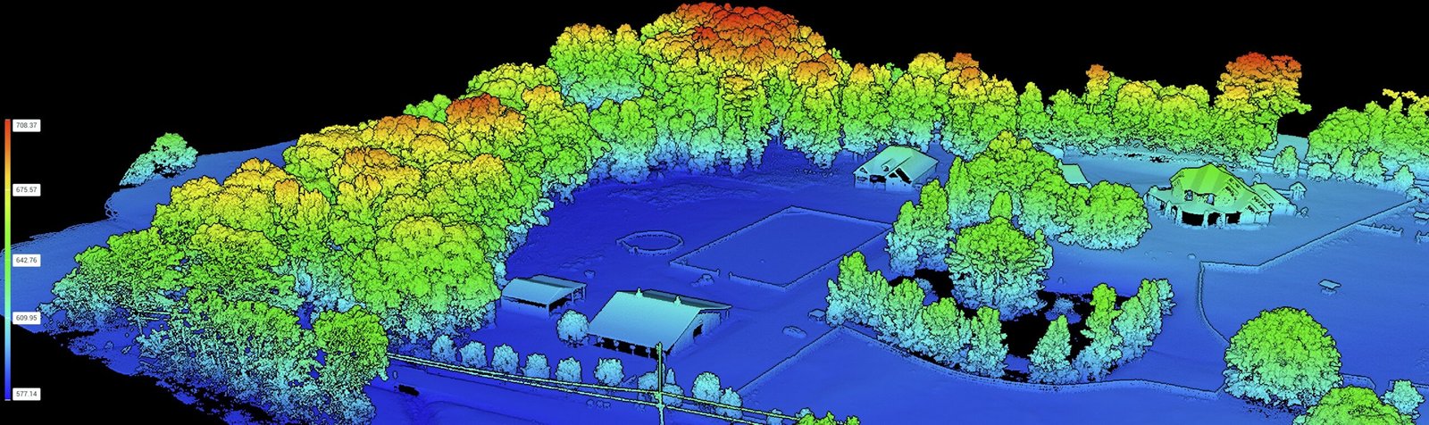
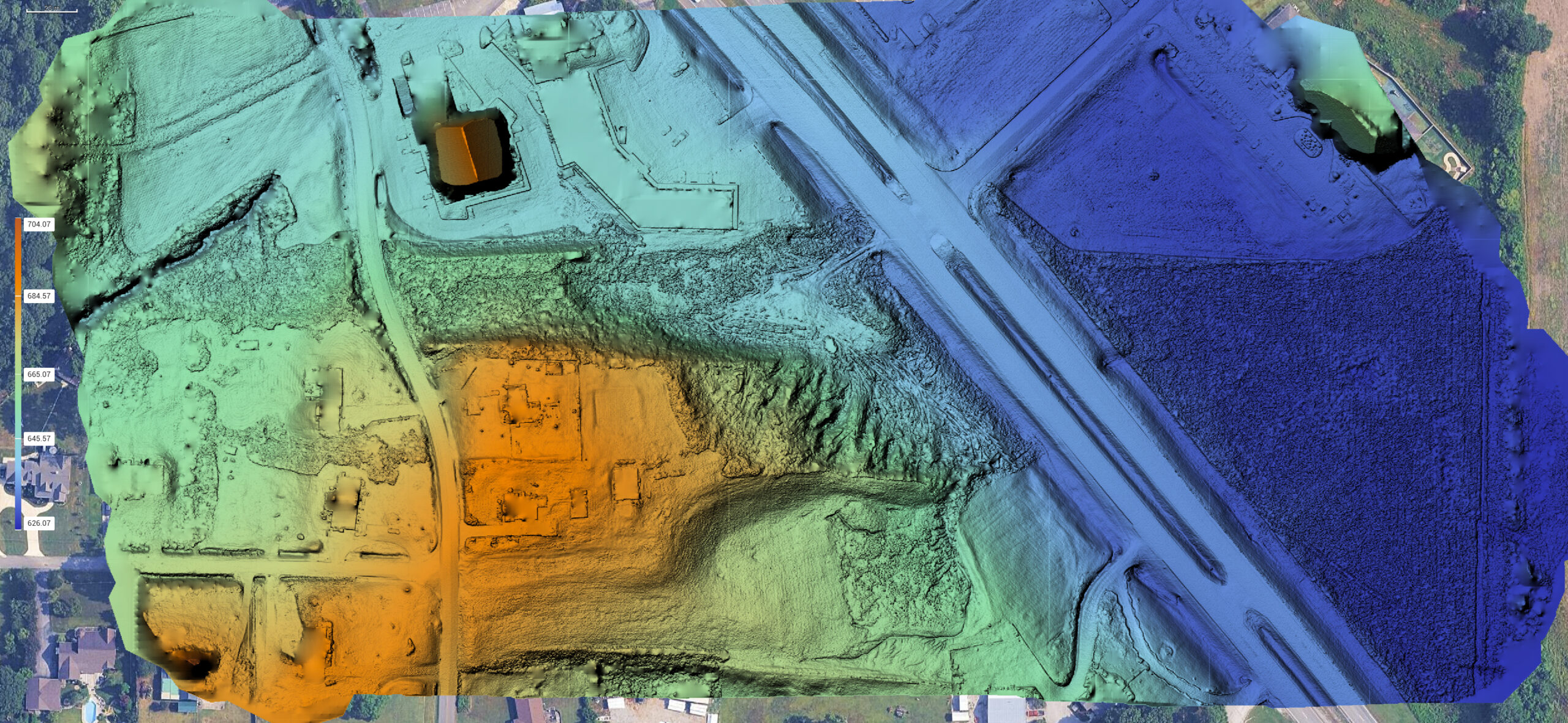
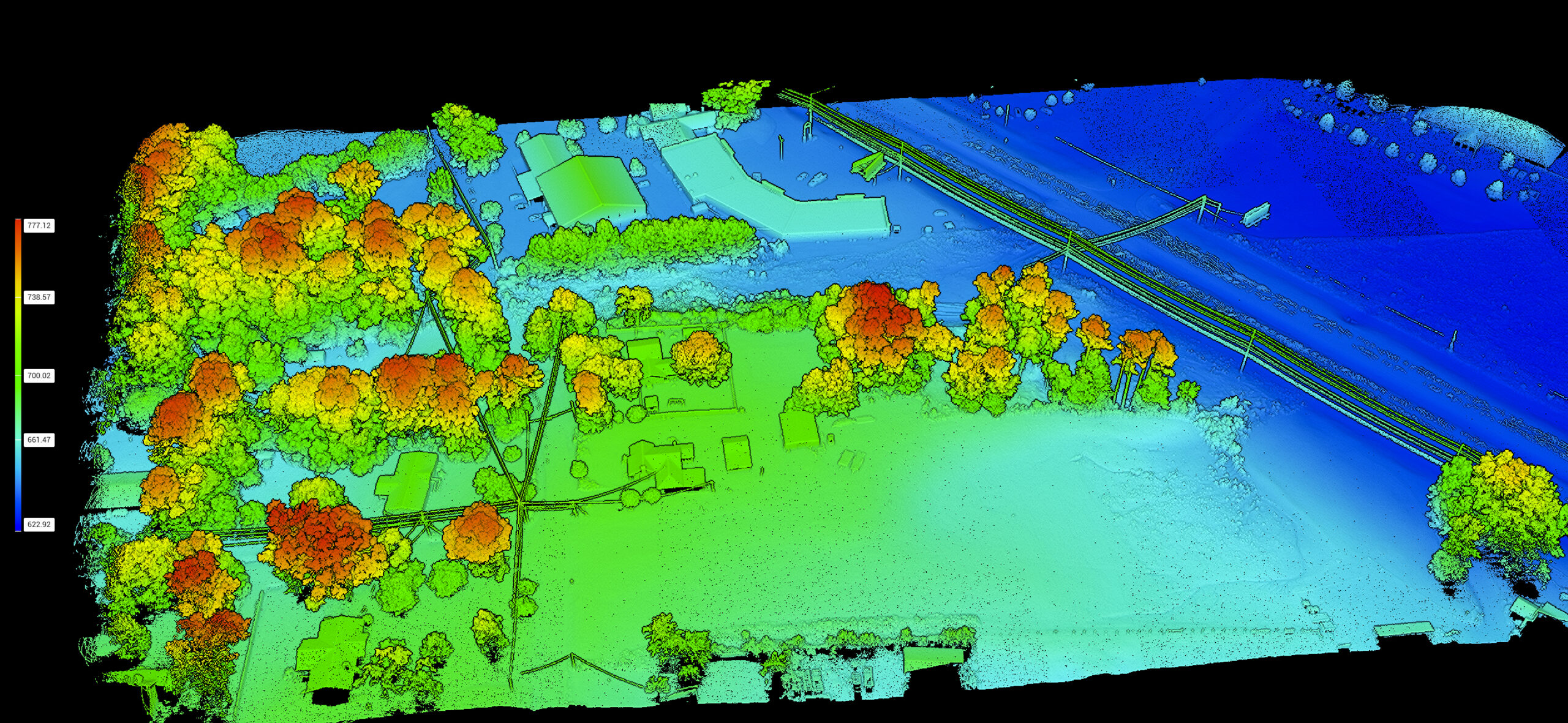
What is LiDAR?
LiDAR (Light Detection and Ranging) is a high-quality remote sensing technology that uses rapid laser pulses to measure the distance between the sensor and objects on the ground.
By emitting hundreds of thousands of laser points per second, LiDAR sensors capture ultra-detailed 3D point clouds that mimic the landscape, vegetation, and built environment with centimeter-level precision.
Why it matters:
- Penetrates vegetation to reveal true ground surfaces and inner layers of forest canopy.
- Captures detailed elevation changes for engineering-grade accuracy and integration with survey deliverables.
- Quicker and more flexible than traditional methods to analyze landscapes previously inaccessible.
What Is LiDAR?
LiDAR (Light Detection and Ranging) is a remote sensing technology that uses rapid laser pulses to measure distances and create detailed 3D maps.
By emitting hundreds of thousands of laser points per second, LiDAR builds ultra-accurate point clouds of terrain, trees, and structures—with centimeter-level precision.
Why It Matters:
Sees Through Vegetation: Reveals ground surfaces beneath tree canopy.
Precision Elevation Data: Ideal for engineering, construction & mapping.
Fast & Flexible: Access areas traditional methods can’t reach—faster.
LiDAR vs. Traditional Surveying
How Modern Aerial LiDAR Outperforms Conventional Land Surveying
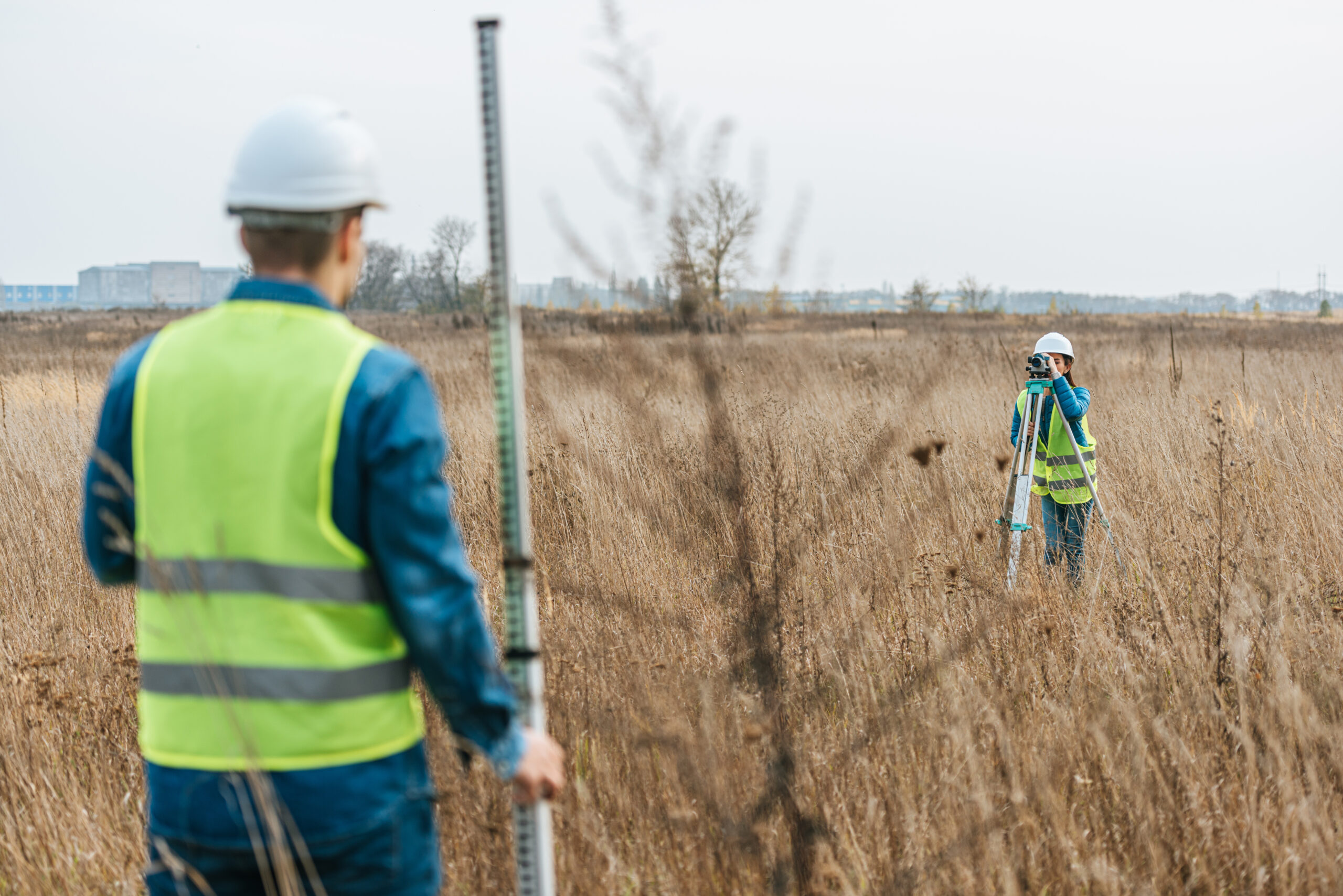
In the past, capturing detailed topographic data meant sending crews on foot with total stations or GNSS rovers — a process that could be slow, labor-intensive, and costly, especially over large or difficult terrain.
Today, LiDAR technology revolutionizes the process.
Using high-precision aerial sensors combined with high-accuracy GNSS receivers, we capture millions of elevation points in a single flight and deliver elevational information faster, safer, and often at a lower cost than traditional surveying methods. These datasets are perfect for integration and supplementation of survey deliverables¹.
LiDAR vs. Traditional Surveying Methods
How Aerial LiDAR Outshines Old-School Surveying Processes
Then:
Crews with total stations or GNSS rovers spent days walking tough terrain—slow, costly, and labor-heavy.
Now:
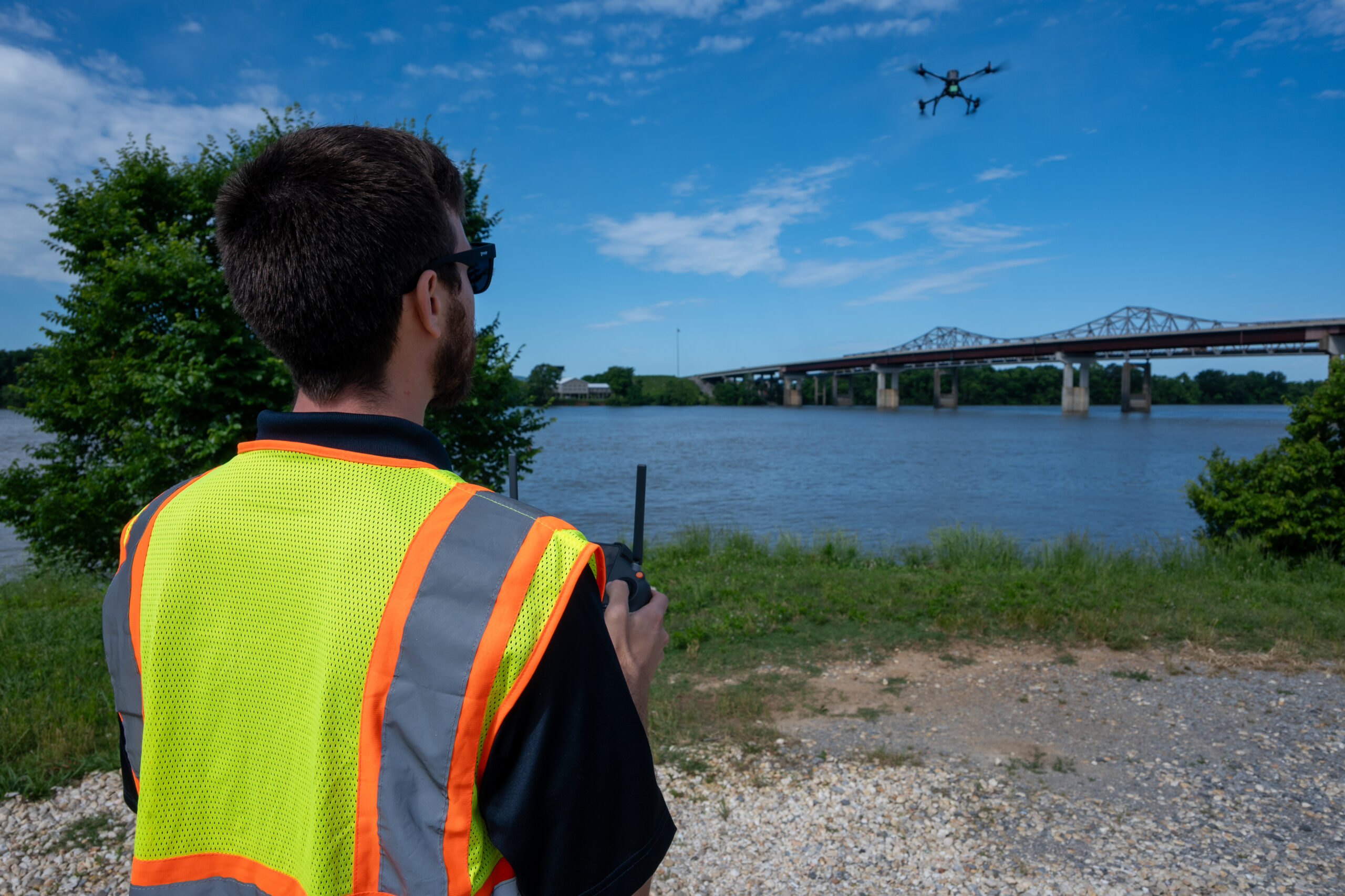
With modern aerial LiDAR, we use drones equipped with:
High-precision LiDAR sensors
Professional-grade GNSS receivers
This allows us to:
Capture millions of elevation points in one flight
Deliver data faster, safer, and more cost-effectively
Seamlessly integrate with survey deliverables¹
| LiDAR Mapping | Traditional Surveying | |
|---|---|---|
| Speed | Large sites scanned in hours | Days or weeks for large projects |
| Terrain Accessibility | Can fly over dense vegetation, wetlands, steep slopes | Difficult or dangerous on foot |
| Safety | No boots on the ground needed | Field crews exposed to hazards |
| Cost Efficiency | Lower cost for large sites | Higher cost over time |
| Environmental Impact | Minimal to no site disturbance | Disturbance from traversing site |
| Final Deliverables | Immediate CAD/GIS-ready files | Manual data processing required |
Why it Matters
- Faster Decision-Making: Shrink your project timelines with quicker and more detailed data-driven insights.
- Higher Accuracy Over Large Areas: Capture micro-elevation changes and ground features invisible to traditional methods.
- Lower Risk: Keep personnel out of unsafe environments — our drones do the heavy lifting.
Why It Matters
Faster Decision-Making
Get detailed insights quicker—shrink project timelines with fast, data-rich deliverables.
Greater Accuracy Over Large Areas
Detect subtle elevation changes and surface details that traditional methods often miss.
Lower Risk
Keep teams safe. Our drones handle hazardous terrain—no need to send crews into risky environments.
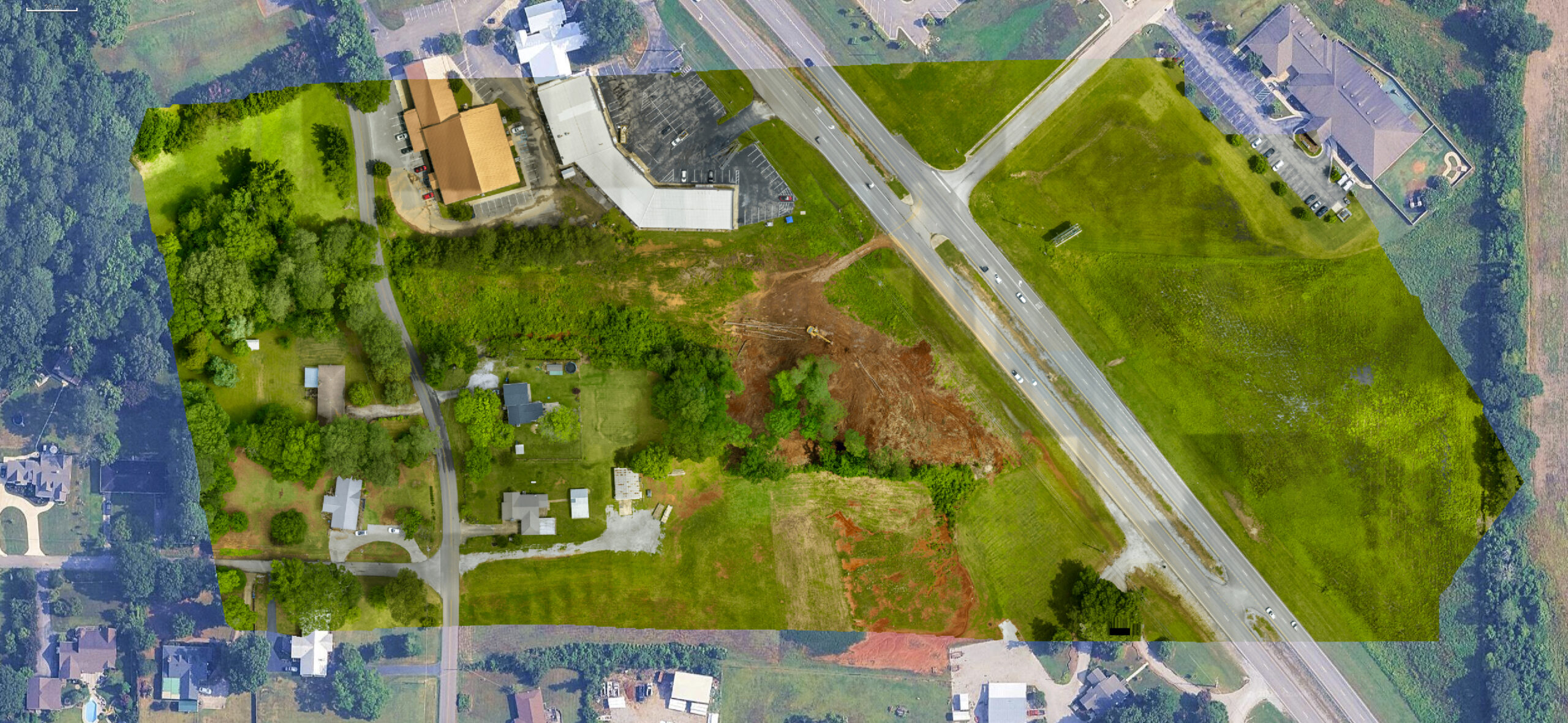
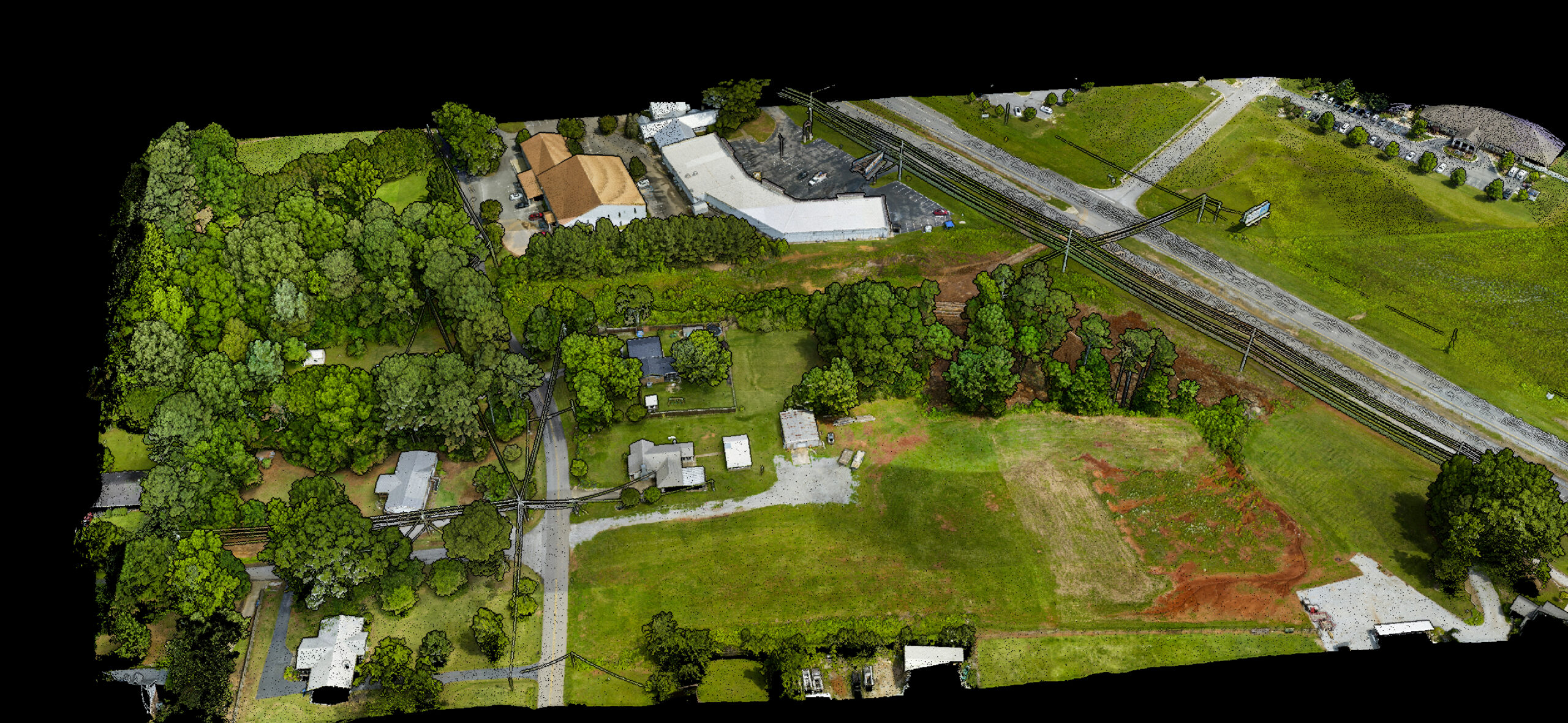
Deliverables We Offer
We go beyond basic drone flights — we deliver full-spectrum LiDAR deliverables tailored to your industry needs.
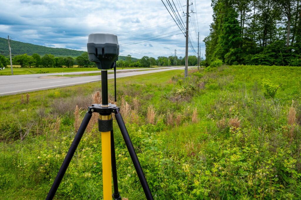
Every project varies, so our team will work with you to provide the exact services and deliverables needed to make your project a success! These services can include professionally established Ground Control Points (GCPs)¹ for enhanced geospatial accuracy and ready-to-use data deliverables that can be brought directly into your preferred software platforms (i.e. AutoCAD, Civil3D, ArcGIS, etc).
✔ GCP-Calibrated Point Clouds (.LAS/.LAZ formats)
✔ Digital Terrain Models (DTM) & Digital Surface Models (DSM)
✔ High-Precision Contour Lines (1’–2′ intervals)
✔ CAD/GIS Integration Formats (.DXF, .DWG, .KMZ, .SHP)
✔ Optional Orthophoto Overlays (true-color aerial imagery tied to LiDAR data and/or Photogrammetric data)
✔ Optional Video Flythroughs (animated 3D visualizations for presentations and planning)
✔ Custom Solutions (unique data deliverables catered specifically to your project needs)
LiDAR Deliverables We Offer
We don’t just fly drones — we deliver industry-ready LiDAR products tailored to your project goals.
Whether you’re working in engineering, planning, or land development, we’ll provide exactly what you need, including **Ground Control Points (GCPs)**¹ for top-tier geospatial accuracy.
Available Deliverables
GCP-Calibrated Point Clouds (.LAS / .LAZ)
Digital Terrain & Surface Models (DTM / DSM)
High-Precision Contours (1’–2′ intervals)
CAD & GIS Formats (.DXF, .DWG, .KMZ, .SHP)
Optional Orthophotos (true-color imagery linked to LiDAR/photogrammetry)
Video Flythroughs (animated 3D visualizations)
Custom Deliverables tailored to your software and workflow
Why LiDAR Is the Future of Mapping
LiDAR isn’t just innovative—it’s redefining how we map and plan.
With:
Unmatched speed & precision
Terrain & vegetation penetration
Data that drives smarter decisions
LiDAR helps reduce costly rework and accelerates project timelines—making it essential for modern development.
Why LiDAR is the Future of Mapping
LiDAR isn’t just a new technology—it’s the future of topographic mapping and site analysis.
With unmatched accuracy, speed, and terrain penetration, LiDAR empowers faster decision-making and reduces costly rework on development projects.
Use Cases for Aerial LiDAR Scanning
Smarter Data. Stronger Decisions.
LiDAR isn’t just advanced—it’s essential. With centimeter-level accuracy and expert-backed workflows, our aerial LiDAR solutions power faster, smarter decisions across industries and project phases.
Civil Engineering & Land Development
From concept to completion:
Pre-Construction Mapping
Evaluate terrain, contours, and elevation for early planning.Grading & Earthwork
Optimize cut/fill, balance materials, reduce waste.Construction Monitoring
Track site changes over time with repeat scans.As-Built Comparisons
Confirm finished grading matches design intent.
Roadways, Trails & Corridors
Efficient coverage for linear projects:
Utility & ROW Mapping
Identify easements, constraints, and topography.Slope & Drainage Analysis
Prevent erosion and plan for runoff.Trail & Greenway Design
Align paths with terrain for accessibility and impact.
Environmental & Agricultural Studies
Reveal what lies beneath:
Vegetation Modeling
Measure tree height, canopy density, biomass.Low-Lying Terrain Detection
Identify subtle depressions, surface drainage patterns, and potential pooling areas.Topographic Change Monitoring
Track landscape evolution over time due to grading, erosion, or vegetation growth.
Infrastructure Monitoring
Data to support long-term asset care:
Bridge & Overpass Scans
Track alignment, deformation, or structural change.Pipeline & Utility Corridors
Monitor surface shifts and potential disturbances.3D Models
Build detailed site visualizations or digital twins.
Cut/Fill & Volume Analysis
Track material movement with precision:
Stockpile Volumes
Quickly measure aggregates, soil, or debris.Earthmoving Quantification
Compare terrain changes over time.Efficiency Monitoring
Keep materials balanced and reduce hauling costs.
Site Planning & Urban Development
A clear view for confident planning:
Subdivision Design
Plan lots, drainage, and roadway layouts.Commercial & Industrial Sites
Guide ADA compliance, grading, and access points.Zoning Support
Elevation data for floodplain and land-use reviews.
Use Cases for Aerial LiDAR Scanning
Expanded Capabilities for Data-Driven Precision
At Bush Drone Data, we combine advanced drone technology with expert workflows to deliver high-resolution LiDAR solutions across a wide range of industries. With the ability to capture millions of precise elevation points from the air, our aerial LiDAR services support smarter planning, faster execution, and more confident decision-making throughout the entire project lifecycle.
Now, in partnership with a licensed surveyor, we offer an even broader spectrum of deliverables—from pre-construction terrain models to certified topographic datasets—tailored to meet the needs of engineers, developers, environmental professionals, and asset managers.
Civil Engineering & Land Development
Our LiDAR solutions provide detailed elevation models that support key phases of site development—from concept through construction:
Terrain Analysis for Site Planning
Rapidly capture ground surface conditions, contours, and topographic variations to inform design, permitting, and feasibility studies.Earthwork & Grading Optimization
Model cut-and-fill operations with precision, reducing material waste and streamlining excavation and foundation work.Construction Progress Tracking
Conduct periodic LiDAR scans to monitor progress, verify design alignment, and document each stage with high-resolution surface data.Final Site Documentation
Support closeout and as-built documentation with detailed elevation datasets that reflect final grading and drainage conditions.
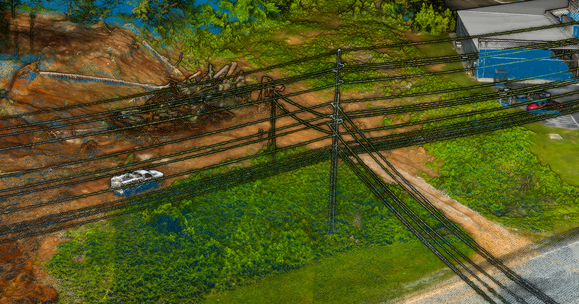
Transportation & Corridor Mapping
For linear infrastructure projects, LiDAR offers efficient and scalable data acquisition along extended alignments:
Utility & ROW Documentation
Identify topographic constraints, encroachments, and surrounding features to support design and coordination across transportation, pipeline, and utility corridors.Slope & Drainage Assessment
Generate accurate slope maps and cross-sections for effective stormwater planning, erosion control, and safety analysis.Trail & Pathway Design
Evaluate terrain suitability and optimize routing for pedestrian, bike, and greenway trail systems with elevation-informed insights.
Environmental & Vegetation Analysis
LiDAR penetrates vegetation to reveal the underlying terrain, making it an essential tool for environmental and conservation work:
Vegetation Canopy Modeling
Capture vertical vegetation structure, canopy height, and biomass data for ecological monitoring, forest planning, or land management.Low-Lying Terrain Detection
Identify subtle surface depressions and drainage tendencies to support site planning and access decisions.Topographic Change Monitoring
Use repeat LiDAR scans to detect grading, erosion, or vegetation changes over time for ongoing site evaluation.
Infrastructure & Asset Monitoring
Aerial LiDAR supports efficient documentation and ongoing analysis of built environments:
Bridge & Structural Profiling
Capture precise geometry and elevation data to support inspections, planning, and visualization of bridges, overpasses, and elevated structures.Utility & Pipeline Corridor Mapping
Monitor terrain along existing infrastructure to detect surface changes, identify risks, and support long-term maintenance planning.3D Modeling for Digital Twins
Generate geo-referenced models for visualization, project coordination, and integration with BIM and GIS systems.
Cut/Fill & Volume Calculations
Volumetric analysis is one of the most practical applications of aerial LiDAR, offering immediate value in construction, mining, and material tracking:
Stockpile Inventory Measurement
Accurately quantify the volume of materials such as aggregates, soil, or construction debris—no ground crews or guesswork required.Earthwork Progress Analysis
Track material movement and calculate cut/fill volumes across evolving job sites using repeatable flight paths and time-series data.Material Balance Optimization
Support hauling decisions and minimize off-site transport through topographic comparisons and mass balance planning.
Urban Development & Commercial Site Design
High-resolution terrain models give planners and developers the data needed to build smarter, faster, and more sustainably:
Subdivision & Lot Planning
Design efficient layouts by understanding slopes, drainage patterns, and site accessibility early in the design process.Commercial Site Preparation
Plan parking, access roads, utilities, and grading strategies with confidence using accurate and up-to-date topographic data.Zoning & Permitting Support
Provide regulatory agencies and stakeholders with clear elevation models that support floodplain compliance and environmental coordination.
Why Choose Bush Drone Data?
When you work with Bush Drone Data, you get more than drone flights—you get local expertise, geospatial precision, and professional-grade results.
What Sets Us Apart:
FAA Part 107 Certified
Licensed, insured, and professionally trained pilots.Based in Huntsville, AL
Serving AL, GA, MS, TN, and FL with pride.Deep Local Knowledge
We know the regulations and terrain like the back of our hand.Fast Turnaround
Most projects delivered in 1–5 business days.Transparent Pricing
No hidden fees. Clear contracts. Quality guaranteed.Cutting-Edge Tech
We use only the most advanced, reliable drone hardware.
Why Bush Drone Data?
When you choose Bush Drone Data, you’re partnering with local drone operators who combine North Alabama knowledge with extensive geospatial expertise.
FAA Part 107 Certified Pilots – Professionally trained and insured.
Based in Huntsville, AL – Proudly serving Alabama, Georgia, Mississippi, Tennessee, and Florida.
Deep Local Expertise – We have extensive knowledge of local ordinances and regulations concerning professional drone operations.
Rapid Data Turnaround – Avg. 1–5 business days.
Transparent Pricing, No Hidden Fees, Quality Assured Contracting
Powered by the Latest Drone Technology – Bush Drone Data only uses the most innovative and highest quality drone technology available.
Let’s Talk LiDAR
Every project is unique. That’s why we build custom flight plans and data collection strategies tailored to your goals—whether it’s 1 acre or 1,000 acres.
Partner with us for:
Precision
Professionalism
Personalized Service
Contact Us
Email: info@bushdronedata.com
Phone: (256) 653-0948
Serving: AL • GA • MS • TN • FL
Let’s Talk LiDAR
Every project is unique — and we specialize in building custom flight and data acquisition plans that align with your project goals.
Whether you’re developing a 1-acre property or a 1000-acre property, we’re ready to support you with precision, professionalism, and personal service.
Contact us today!
info@bushdronedata.com
(256)-653-0948
Serving Alabama, Georgia, Mississippi, Tennessee, and Florida

¹Bush Drone Data LLC provides aerial imaging, LiDAR, and terrestrial modeling services in coordination with licensed land surveyors as required by applicable state law.
