Why Use Drones?
In fast-moving industries, precision, speed, and cost-efficiency are essential. Traditional data collection methods are often labor-intensive, time-consuming, and limited by terrain or accessibility.
Drones change the game.
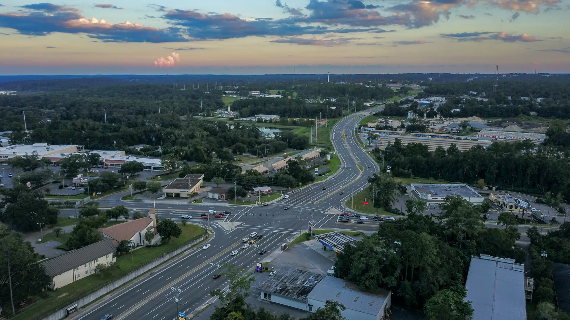
They deliver high-resolution data, rapid deployment, and safe access to hard-to-reach areas—cutting down costs while improving accuracy.
At Bush Drone Data, we use advanced drone technology to provide faster, safer, and more tailored insights across industries like construction, infrastructure, real estate, agriculture, and public safety.
Smarter data. Better decisions. Faster results.
The Advantages of Drone Technology
1. Unparalleled Efficiency & Speed
Traditional surveying can take days—or even weeks—to complete. With drone technology, you can survey large areas in a fraction of the time and receive actionable insights within hours.
Key Benefits:
-
Fast data collection
Accelerate timelines with rapid, real-time results. -
Automated flight planning
Capture precise data efficiently—no manual guesswork. -
Streamlined workflows
Easily integrate outputs into CAD, GIS, and 3D modeling platforms.
Drone-driven efficiency means fewer delays, faster decisions, and greater productivity across your entire operation.
2. Increased Accuracy & Data Precision
Drones equipped with RTK (Real-Time Kinematic) and PPK (Post-Processing Kinematic) systems deliver centimeter-level accuracy—surpassing conventional GPS-based methods. By integrating Ground Control Points (GCPs) and advanced photogrammetry, our drones produce highly reliable, real-world georeferenced data.
Key Benefits:
-
Centimeter-level accuracy
RTK/PPK systems ensure exact geospatial measurements. -
High-resolution imagery
Generate detailed terrain models with exceptional clarity and depth. -
Consistent, repeatable results
Capture reliable data that aligns with real-world coordinates—every time.
With drones, you get the precision and consistency your projects demand.
3. Enhanced Safety & Reduced Risks
Traditional inspection methods—like climbing scaffolding or flying helicopters—can put workers in harm’s way. Drones remove the risk by performing remote inspections of hazardous or hard-to-reach areas, all while staying compliant with safety standards.
Key Benefits:
-
Minimized human exposure
Keep personnel out of dangerous environments. -
Remote access to high-risk sites
Safely inspect rooftops, towers, power lines, and bridges from above. -
Less disruption to operations
Eliminate the need for ladders, scaffolding, or pausing on-site activity.
Drones offer a safer, smarter way to gather the data you need—without compromising your team’s well-being.
4. Cost-Effective Solutions
Conventional surveying and inspection methods often come with high costs—from equipment rentals to labor and logistics. Drone technology slashes those expenses while delivering faster, more accurate results.
Key Benefits:
-
Lower operational costs
Eliminate the need for helicopters, cranes, or large ground crews. -
Faster project completion
Speed up surveys, inspections, and progress monitoring. -
Affordable, high-quality data
Get professional-grade results without the overhead of traditional methods.
Drones provide a smarter, more economical alternative for businesses looking to optimize both performance and budget.
5. Versatility Across Multiple Industries
Drones are incredibly adaptable, offering scalable solutions across diverse industries. Whether you’re tracking construction progress or managing farmland, drones deliver the right data for the job—efficiently and safely.
Industries That Benefit:
-
Construction & Development
Monitor progress, measure stockpiles, and generate 3D site models. -
Infrastructure & Utilities
Inspect bridges, towers, pipelines, and solar farms with ease. -
Real Estate & Marketing
Capture eye-catching aerial photos and cinematic property videos. -
Agriculture & Land Management
Evaluate crop health, spot irrigation issues, and maximize land use. -
Public Safety & Emergency Response
Support search and rescue, disaster assessments, and traffic monitoring.
Drones bring precision, flexibility, and value to nearly every sector.
Why Choose Bush Drone Data?
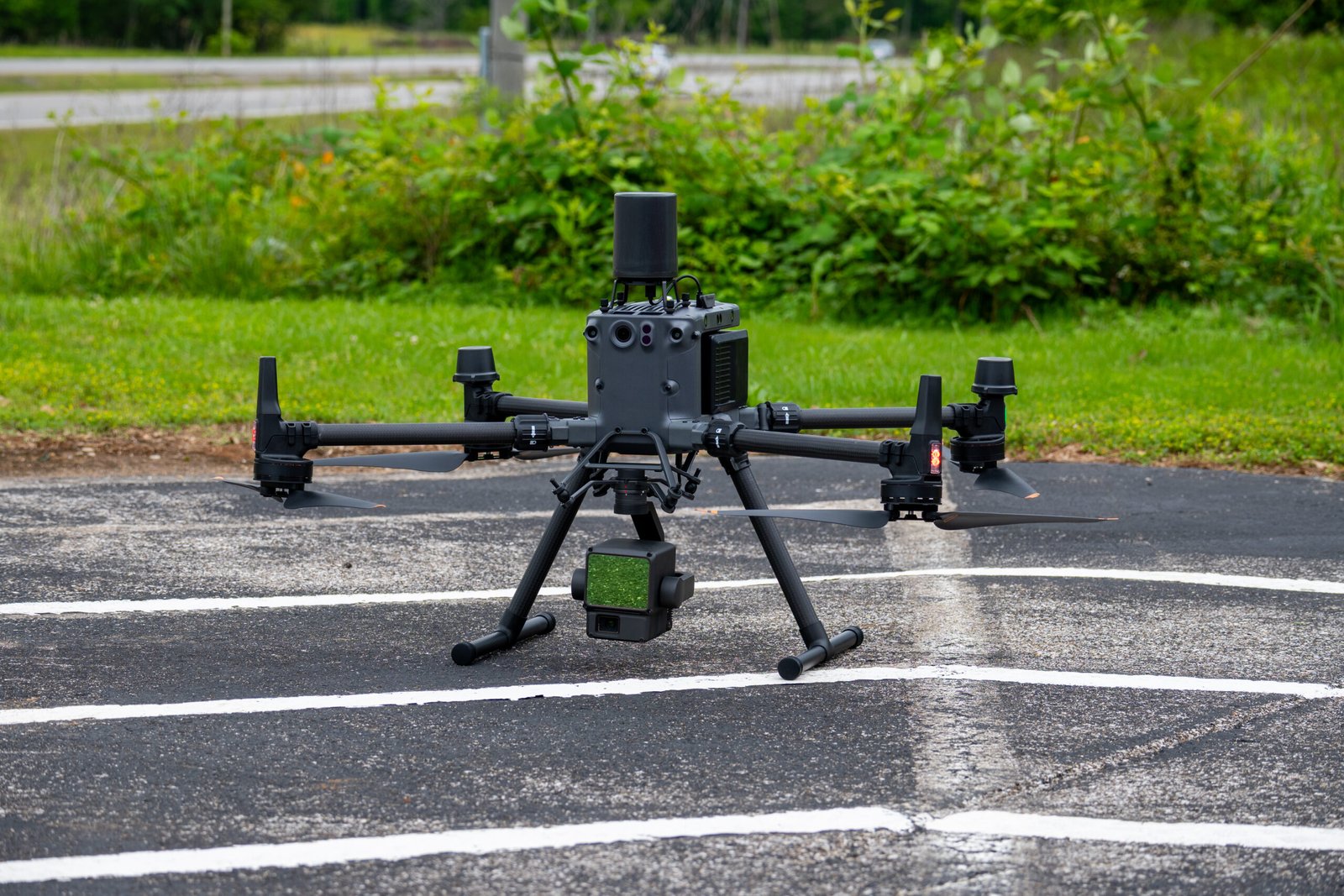
At Bush Drone Data, we deliver more than just drone services—we provide precision-driven solutions powered by expertise, advanced technology, and deep local knowledge. Our FAA-certified pilots use RTK/PPK positioning and high-resolution imaging to give you the accurate, actionable data you need to move faster and make smarter decisions.
What Sets Us Apart:
-
FAA-Certified & Insured Operators
Licensed professionals committed to safety and compliance. -
RTK/PPK Accuracy + GCP Integration
Centimeter-level precision for mapping, modeling, and inspection. -
Fast Turnaround Times
Streamlined workflows that deliver insights—fast. -
Custom Solutions by Industry
Services tailored to your sector’s unique requirements.
Get Started with Bush Drone Data Today
Drones are transforming the way businesses collect and use data—offering greater efficiency, accuracy, and cost savings than traditional surveying methods.
Whether you need construction monitoring, infrastructure inspections, precision mapping, or aerial media for marketing, Bush Drone Data delivers customized solutions built around your goals.
Ready to elevate your operations?
Contact us today to discuss your project and discover how our drone services can take your business to new heights.
Why Use Drones?
In today’s fast-paced industries, precision, efficiency, and cost-effectiveness are critical when it comes to data collection, project monitoring, and asset management. Traditional data-gathering methods often require significant time, labor, and resources, while still being subject to human error and accessibility limitations. This is where drone technology offers a game-changing advantage, providing high-resolution data, rapid deployment, and unmatched accessibility across multiple industries.
At Bush Drone Data, we leverage cutting-edge drone technology to deliver faster, safer, and more accurate insights tailored to your specific needs. Whether you’re in construction, infrastructure, real estate, agriculture, or public safety, drones offer a highly efficient alternative to conventional surveying and data collection methods.
The Advantages of Drone Technology
1. Unparalleled Efficiency & Speed
Traditional surveying methods can take days or even weeks to collect and process data. Drones, however, can survey large areas in a fraction of the time, delivering actionable insights with rapid turnaround times. Aerial data can be processed within hours, enabling businesses to make quick, informed decisions without costly delays.
Fast data collection – Reduce project timelines with real-time insights.
Automated flight planning – Efficient data acquisition without human limitations.
Streamlined workflows – Seamless integration with CAD, GIS, and 3D modeling software.

2. Increased Accuracy & Data Precision
Drones equipped with RTK (Real-Time Kinematic) and PPK (Post-Processing Kinematic) positioning systems offer centimeter-level accuracy, far exceeding conventional GPS-based methods. With the use of Ground Control Points (GCPs) and advanced photogrammetry, drones ensure that every measurement is georeferenced to real-world coordinates, providing highly accurate maps, 3D models, and volumetric data.
Centimeter-level accuracy – RTK/PPK-enabled drones ensure precise geospatial data.
High-resolution imagery – Capture detailed terrain models with superior depth perception.
Consistent, repeatable results – Data that aligns with real-world coordinates for reliable analysis.

3. Enhanced Safety & Reduced Risks
Conventional data collection methods, such as manual site inspections, scaffolding surveys, and helicopter flyovers, expose workers to potential hazards and high-risk environments. Drones eliminate the need for personnel to enter dangerous or inaccessible areas, drastically reducing the likelihood of accidents while maintaining compliance with safety regulations.
Minimized human exposure – Reduce risks in hazardous environments.
Remote access to dangerous sites – Inspect rooftops, towers, power lines, and bridges safely.
Less disruption to active sites – No need for scaffolding, ladders, or on-ground interruptions.

4. Cost-Effective Solutions
Traditional surveying and inspection methods require significant financial investments in equipment, labor, and logistics. Drones dramatically cut costs by reducing manual labor, equipment rentals, and travel expenses, all while improving efficiency and accuracy.
Lower operational costs – Reduce the need for helicopters, cranes, or ground crews.
Faster project completion – Save time on inspections, surveys, and construction monitoring.
More affordable than traditional methods – High-quality data without the high overhead costs.

5. Versatility Across Multiple Industries
Drones are highly adaptable, making them valuable assets across a wide range of industries. From construction site progress tracking to precision agriculture, infrastructure inspections, and environmental monitoring, drones provide tailored solutions for every sector.
Construction & Development – Track project progress, measure stockpiles, and create 3D models of job sites.
Infrastructure & Utilities – Inspect bridges, cell towers, pipelines, and solar farms with aerial imaging.
Real Estate & Marketing – Capture stunning aerial photography and cinematic property showcases.
Agriculture & Land Management – Assess crop health, detect irrigation issues, and optimize land use.
Public Safety & Emergency Response – Aid search and rescue operations, disaster assessments, and traffic monitoring.

Why Choose Bush Drone Data?
At Bush Drone Data, we combine expertise, advanced technology, and local knowledge to provide customized drone solutions that enhance efficiency, accuracy, and safety. Our FAA-certified drone pilots utilize RTK/PPK precision technology, and high-resolution imaging to deliver actionable data that helps businesses make smarter, faster decisions.
FAA-Certified & Insured Operators – Professional, licensed, and compliant drone pilots.
Advanced RTK/PPK & GCPs for Accuracy – Centimeter-level precision in every project.
Fast Turnaround Times – Efficient workflows for rapid project insights.
Custom Solutions for Your Industry – Tailored services to meet your specific needs.
Get Started with Bush Drone Data Today!
Drones are revolutionizing data collection, offering unmatched efficiency, accuracy, and cost-effectiveness compared to traditional surveying methods.
Whether you need construction site monitoring, infrastructure inspections, precision mapping, or promotional aerial media, Bush Drone Data provides tailored drone solutions to meet your unique needs.
Ready to elevate your business with cutting-edge drone technology? Contact us today to discuss your project and see how our aerial solutions can transform the way you work.